What is recorded here
Ardanragh Castle stood as a tower house on a low rise in County Longford until demolition in 1906, leaving behind cut stone and a farmhouse that absorbed its shadow. Bryan fferrall once watched cattle from its battlements while fearing the Toryes, proving the walls served living people rather than mapmakers. The castle vanished into pasture and memory, but its stones still lie scattered near the house that replaced it.
On a low rise in otherwise level pasture, immediately to the SW of a 19th-century farmhouse. A land grant to John Farrell in 1620, under the commission for the Plantation of Longford, included ‘The lordship, castle, town and lands of Ardenragh’ (Cal. pat. rolls Ire., Jas I, 466). The castle is depicted on an early 17th-century map of Shrule barony (BL, Cotton MS Augustus I.ii.26) and is shown as a large castellated structure, within a cluster of smaller buildings, on the Down Survey (1655-6) map of the barony (NLI, MS 719). The 1641 depositions record that ‘Bryan fferrall of Ardanragh’ was standing ‘on the battlements of the Castle of Ardanragh about ffebruary last was a yeare watching the Cattle belonging to himselfe and his Nephew for feare of the Toryes’ (TCD, MS 817, fol. 242r). A report in 1977 (SMR file) noted that no was no visible surface trace of the castle. Part of it may have been incorporated into the farmhouse but there was no indication of this to be seen on ground or in the appearance of the house.
In February 2021, photographs posted on Facebook by the owner of the house at Ardanragh, Co. Longford, included an old postcard of the castle dated 1881 and photographs of punch-dressed cut stone lying around the place. The post on facebook stated that 'Some of the decorative stones from the historic Ardandragh Castle, demolished in 1906 when some of the stepping stones around the rooftop became loose. This house built in 1814 as an addition to the castle (front view ) is standing and is known as “Castle Farm“ on the old OS maps. The photograph of the castle shows that it was the remains of a tower house standing on the SW end of Ardanragh House.
See attached photographs of cut stone from levelled castle and old B/W photograph of the castle provided courtesy of Kieran Campbell
Compiled and revised by: Caimin O'Brien based on details provided by Kieran Campbell
Date of revised upload: 3 June 2022
Ardanragh Castle was built as part of the Plantation of Longford in the early 17th century, following a 1620 land grant to John Farrell. It is remembered as an example of early colonial architecture and land redistribution in Ireland under English rule.
The monument record does not grant public access. Check the route and ask the landowner before entering private land.
- What survives
- Recorded monument
Places near here
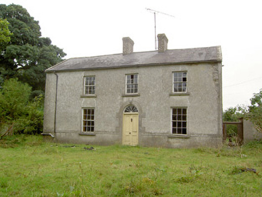 Castle Farmhouse · 11 yd
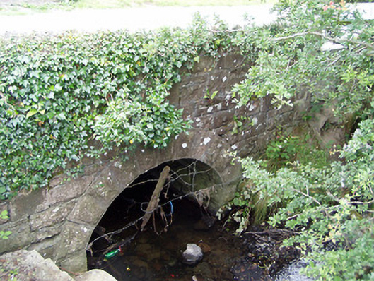 bridgebridge · 1095 yd
 Indicated FortFairy fort / earthen ringfort · 1332 yd
 Common AlderCommon Alder · 1390 yd
 Hachured FortsFairy fort / earthen ringfort · 1532 yd
 Pedunculate OakPedunculate Oak · 1673 yd
 Bawn in EmperBawn · 1.8 mi
 Abbeyshrule AbbeyRuins · 2.5 mi
 CastleCastle, motte · 2.9 mi
 Goldsmith Birthplace, PallasVisitor information · 4.3 mi
 Craft WorkshopHeritage attraction · 4.8 mi
 Guest ServicesVisitor information · 4.9 mi