Places near here
Photo credits
- Colin Park, Wikimedia Commons · CC BY-SA 2.0
- Jon Sullivan, Wikimedia Commons
- Willie Duffin, Geograph · CC BY-SA 2.0
- Gordon Hatton, Geograph · CC BY-SA 2.0
- Hellowiki789, Wikimedia Commons · CC BY-SA 3.0
- Michael Murtagh, Geograph · CC BY-SA 2.0
- Suzanne Mischyshyn, Geograph · CC BY-SA 2.0
- National Inventory of Architectural Heritage
- A.-K. D., Wikimedia Commons · CC BY-SA 4.0
- John M, Wikimedia Commons · CC BY-SA 2.0
- Oliver Dixon, Geograph · CC BY-SA 2.0
 Gleniff Barytes MineRuins · 1263 yd
Explorer Tom Gleniff Barytes Mine has a family tree that’s mostly just rocks and one very confused badger who moved in during the 90s. It mined baryte for decades until the whole operation got a bit too expensive and silly. Pick a stone, any stone, and invent its biography.
 The Devil's ChimneyWaterfall · 1.6 mi
Explorer Tom The Devil's Chimney is a waterfall that sometimes refuses to fall. A southerly wind can blow its water back over the cliff, which explains the Irish name Sruth in Aghaidh an Aird, stream against the height. At about 150 metres it is Ireland's highest waterfall, when it is actually flowing; the stream runs for roughly 200 days in a typical year. I would promise to turn the wind on for you, but Donegal weather takes no orders from me. The drop stands by Glencar Lough on the Sligo-Leitrim border. Use the public walking trail, check recent rain, wind and ground conditions, and stay clear of steep edges. Look up from a safe spot near the base. If the water blows upward, you can tell people you saw a waterfall argue with gravity and win.
 Glencar Lough ViewpointViewpoint · 1.7 mi
Explorer Tom Glencar Lough Viewpoint is playing hard to get, hiding behind a waterfall that looks like it dropped out of a fantasy novel. I heard there was a matchmaker there once, but she mostly just matched rocks with cliffs. Best enjoyed with a bag of chips and no plans.
 BenwiskinMountain / peak · 1.7 mi
Explorer Tom Benwiskin smells like wet wool and regret if you ask me. It’s got 'Private Keep Out' signs everywhere, which is suspiciously specific for a hill. Ten minutes here and you'll have a yarn for the pub.
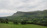 BenbulbenMountain · 1.9 mi
Explorer Tom Benbulben would handle a nosey neighbour by just standing there silently, letting the sheer size of it do all the talking without lifting a finger. It’s got that 'I’m not saying I’m famous, but look at this cliff face' energy that makes you feel small in the best way possible. It's free, it's odd, what more do you want?
 Kings MountainMountain / peak · 2.0 mi
Explorer Tom Kings Mountain in County Sligo was saved by a hero so obscure even his own ghost forgets his name. It stands tall over the bog, pretending it didn't just fall asleep on the job. Pop by and tell it it's looking well.
 Gleniff Horseshoe DriveViewpoint · 2.5 mi
Explorer Tom Gleniff Horseshoe Drive is such a poser; it probably posts selfies every five minutes to show off its curves. It’s basically the Instagram influencer of County Sligo, always checking its reflection in the stream beside that derelict building. Bring a flask of something warm and a story to swap.
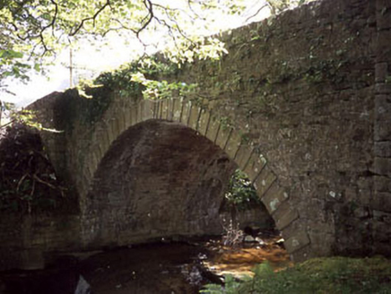 Ballaghnatrillick BridgeBridge · 2.5 mi
Explorer Tom Ballaghnatrillick Bridge in Clogh has an elegant arch that the wind keeps picking on like a sore thumb, whistling through those alternating voussoirs all day long. The mountains behind it are just there to make it look like the bridge is doing something important, which I suppose it is, by staying up. Try not to lean over too much; the stone construction is fancy but not fussy about your balance.
 Holy well in KeelogesHoly well · 2.6 mi
Explorer Tom Holy well in Keeloges is hiding behind a lack of uploaded information, which makes me think it’s playing hard to get just because it can afford to be mysterious. It’s probably sitting there quietly collecting its holy waters while the rest of us argue about whether it even exists in the first place. Stop the car, it's worth the hazard lights.
 Stone head in KeelogesStone head · 2.6 mi
Explorer Tom Stone head in Keeloges is stuck in a dramatic feud with the nearest tree, both insisting they are the more interesting one. One is made of granite and stubbornness; the other just keeps growing leaves at it. Have a nosey, politely.
 Glencar WaterfallVisitor information · 2.7 mi
Explorer Tom Glencar Waterfall would survive a zombie attack by just standing there and splashing them. It’s got more stamina than most of us and absolutely zero patience for nonsense. Leave nothing but footprints and a bad pun.
 Glencar IslandIslet · 2.9 mi
Explorer Tom Glencar Island in County Leitrim would complain to the council about the noise levels from the swans, claiming they’re violating its quiet hours and disrupting its ancient meditative state. It’s tired of being a scenic backdrop and wants some peace and quiet, or at least a proper fence around it. Perfect spot to practise your best tour-guide voice.
More mountains and hills in County Sligo · All of County Sligo

What do you know about this place?Tap to add a comment or ask a question