What is recorded here
Amy Jane is a motor fishing vessel in Argyll and Bute, Scotland.
From the Historic Environment Scotland record 324596
The historic-place record does not grant public access. Check current conditions and ownership before entering land or a building.
Places near here
Photo credits
- Andreas F. Borchert, Wikimedia Commons · CC BY-SA 4.0
- National Inventory of Architectural Heritage
- Arnold Price, Wikimedia Commons · CC BY-SA 2.0
- David Dixon, Wikimedia Commons · CC BY-SA 2.0
- David Dixon, Geograph · CC BY-SA 2.0
- Kenneth Allen, Wikimedia Commons · CC BY-SA 2.0
- N Chadwick, Wikimedia Commons · CC BY-SA 2.0
- N Chadwick, Geograph · CC BY-SA 2.0
- Dr Neil Clifton, Wikimedia Commons · CC BY-SA 2.0
Mass-rock in InishtrahullMass-rock · 12 mi InishtrahullIsland · 12 miInishtrahull Lighthouse (old)Lighthouse, lighthouse keeper's house · 12 miInishtrahull LighthouseLighthouse · 13 miEire 80 signSecond World War neutrality sign · 16 miPebble StrandBeach / strand · 16 miWild Atlantic Way:Malin HeadVisitor information · 16 miMalin HeadHeritage attraction · 16 miMalin TowerSignal tower · 16 miHell's Hole Cavern, Malin HeadSea cavern and cliff chasm · 17 miSkildrenbegIslet · 17 miWee House of Malin CaveCave · 17 mi
 InishtrahullIsland · 12 mi
 Inishtrahull Lighthouse (old)Lighthouse, lighthouse keeper's house · 12 mi
 Inishtrahull LighthouseLighthouse · 13 mi
 Eire 80 signSecond World War neutrality sign · 16 miPebble StrandBeach / strand · 16 mi
 Wild Atlantic Way:Malin HeadVisitor information · 16 mi
 Malin HeadHeritage attraction · 16 mi
 Malin TowerSignal tower · 16 mi
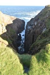 Hell's Hole Cavern, Malin HeadSea cavern and cliff chasm · 17 mi
 SkildrenbegIslet · 17 mi
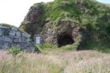 Wee House of Malin CaveCave · 17 mi
More wrecks and historic events in Argyll and Bute · All of Argyll and Bute
What do you know about this place?