
Places near here
Photo credits
- N Chadwick, Geograph · CC BY-SA 2.0
- N Chadwick, Wikimedia Commons · CC BY-SA 2.0
- National Inventory of Architectural Heritage
- Alex McGregor, Geograph · CC BY-SA 2.0
- Chris-from-mayo, Wikimedia Commons · CC BY-SA 4.0
- Mike Searle, Geograph · CC BY-SA 2.0
- Phonohan, Wikimedia Commons · CC BY-SA 4.0
- Steve Edge, Geograph · CC BY-SA 2.0
- Mike Searle, Wikimedia Commons · CC BY-SA 2.0
 Ww2 Éire MarkerHeritage attraction · 137 yd
Explorer Tom WW2 Éire Marker: This marker looks like it’s got an imaginary twin across the Atlantic, just waiting for a phone call that never came. Ireland stayed neutral while the world went to pieces, so this stone is basically the ultimate eye-roll in concrete. It stands there saying 'we were busy' with great dignity. Bring curiosity, leave with a better story than mine.
 Dún BristeVisitor attraction · 173 yd
Explorer Tom Dún Briste in Mayo has clearly made a New Year's resolution to stop crumbling, but it hasn't exactly stuck to the plan yet. The name means Broken Fort, so it's been a bit transparent about its structural integrity for centuries now. Best seen with a hangover and a sausage roll.
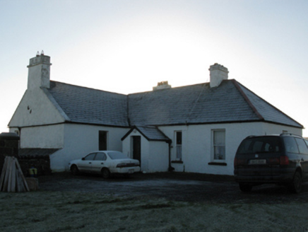 rectory/glebe/vicarage/curate's house2.5 mi
Explorer Tom This Doonfeeny Upper rectory has high walls because the vicar needed privacy from his own thoughts. It would rate visitors on their shoe polish and general obedience to church law. Practise your Irish before you approach it politely.
 Ballycastle BeachBeach / strand · 2.6 mi
Explorer Tom Ballycastle Beach is proud of its ability to turn nice trousers into swamp cakes in under ten minutes. It’s got a reputation for looking better on postcards than it does in person, which is unfair. The shingle there crunches loudly enough to wake the dead if you walk wrong. Walk past slowly like you're in a film.
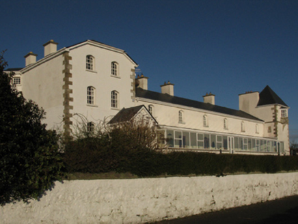 Ballycastle Coastguard StationCoastguard station · 2.6 mi
Explorer Tom Ballycastle Coastguard Station has a long-standing grudge against the weather, even though they just did a total makeover to impress it. It thinks it’s back in business, but the ocean remains unimpressed. Take the long way round.
 Court tomb in RathlackanCourt tomb · 3.6 mi
Explorer Tom Court tomb in Rathlackan has a dating profile that just says: 'Ancient, solid, no drama.' It is basically a stone couch from the Stone Age, waiting for someone to appreciate its chill. Ideal stop for a big stretch and a bigger yawn before we move on.
 Céide Fields Visitor CentreVisitor information · 4.6 mi
Explorer Tom Céide Fields Visitor Centre has this tall tale about a hidden tunnel to the pub going around. I’m not sure if it’s true, but I’m choosing to believe it for now. The fields are ancient, so they’ve had plenty of time to hide a few secrets. Bring a coin for luck and keep it in your pocket.
 CastleCastle, unclassified · 5.0 mi
Explorer Tom A love story went terribly wrong next to Castlelackan Demesne; she left him for a man with better hair and no history. The castle still looks heartbroken. Perfect detour when your satnav has a complete meltdown.
 CromlechsWedge tomb · 7.0 mi
Explorer Tom Cromlechs in Rathfranpark are locked in a silent staring contest with the nearest tree. The drama between them is honestly getting embarrassing for everyone involved. Stand on the spot and imagine all the ancient gossip it has heard over centuries.
 Templemurry GraveyardCemetery · 7.5 mi
Explorer Tom Templemurry Graveyard would survive a zombie attack simply by standing still and letting them trip over all the headstones in their path repeatedly until they get bored of it. It’s got a passive defense strategy that is surprisingly effective against anything that doesn’t know how to watch its footing carefully enough. Stand on the spot and imagine the gossip it's heard.
 Rinnaun PointHeadland · 9.0 mi
Explorer Tom Rinnaun Point is the center of a local superstition that says if you whistle at it, your car will never start again for exactly three days. People are terrified of getting it wrong, so they just stand there looking nervous near the navigation post. It’s the ultimate way to test how much faith you have in fate. If it's closed, admire it from the road like a polite stalker.
_-_geograph.org.uk_-_4073208.jpg/250px-Castles_of_Connacht,_Rathroe,_Mayo_(1)_-_geograph.org.uk_-_4073208.jpg "Photo: Mike Searle, Wikimedia Commons · CC BY-SA 2.0") Rathroe CastleCastle · 9.1 mi
Rathroe CastleCastle · 9.1 miExplorer Tom Rathroe Castle would win the lotto by buying a really big umbrella and wearing it like a hat. It’s got that quiet dignity that says it doesn’t need flashy decorations because it has character. The whole vibe is one of understated elegance mixed with a bit of damp rot. Bring curiosity, leave with a better story than mine.
More archaeology and monuments in County Mayo · All of County Mayo

What do you know about this place?Tap to add a comment or ask a question