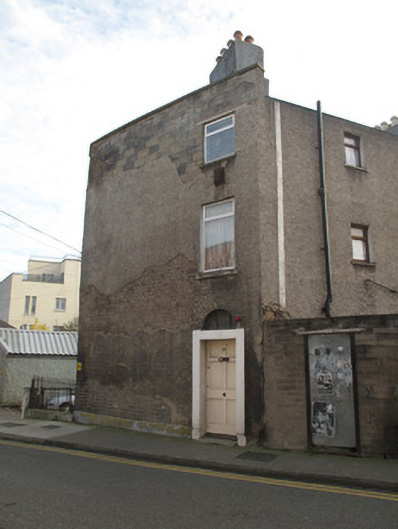
What is recorded here
Detached single-bay three-storey over basement former widows almshouse, built c.1720, having four-bay side elevation, with angled corner to north-west and two-storey extension to west elevation. Pitched artificial slate roof, hipped to front (north) elevation, terracotta ridge tiles, rendered chimneystacks having clay…
Read the whole record
From the Buildings of Ireland (National Inventory of Architectural Heritage) record 50070181
Places near here
Photo credits
- Maker not stated on source page, en.wikipedia.org
- Maker not stated on source page, commons.wikimedia.org
- Maker not stated on source page, www.tripadvisor.com
- Maker not stated on source page, www.pinterest.com
- Maker not stated on source page, www.flickr.com
- Maker not stated on source page, www.tripadvisor.ca
- Maker not stated on source page, tr.pinterest.com
- National Inventory of Architectural Heritage
- Keith Weller, Wikimedia Commons · Public domain
- Taken by Fanghong, Wikimedia Commons · CC BY-SA 3.0
 Graveyard in Unknown TownlandGraveyard · 276 yd
Explorer Tom Graveyard in Dublin dates from 1704 to the 1920s at Arbour Hill. Most graves are for British military personnel, and…
 CairnCairn, unclassified · 320 yd
Explorer Tom Cairn. Known as Carn Uí Dúnchada, this cairn was possibly erected against Viking pressure in the ninth century. Using a…
 Church in Donnybrook East,donnybrook WestChurch · 320 yd
Explorer Tom Church in Donnybrook East is mentioned in a deed from 1748, which is quite specific for a ghost church. It was the…
 Church in DonnycarneyChurch · 320 yd
Explorer Tom Church in Donnycarney exists by tradition, which means nobody is really sure where it is. Wren says there was one…
 Megalithic tomb in Dublin North CityMegalithic tomb · 320 yd
Explorer Tom Megalithic tomb in Dublin North City. Recorded as a sepulchre of black marble stones, now lost to the city's expansion.…
 Church in Dublin North CityChurch · 320 yd
Explorer Tom Church in Dublin North City is near the north gate of St Mary's Abbey and apparently doesn’t exist anymore, which is a…
 Church in Dublin South CityChurch · 320 yd
Explorer Tom Church in Dublin South City was at Dolphin's Barn and showed up on the Down Survey map, so it definitely existed for a…
 TombTomb, unclassified · 320 yd
Explorer Tom Tomb in Dublin South City belongs to the Low family from the 17th century. John Low built it big. If you see a fancy…
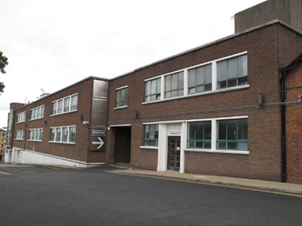 Digital Depot/NCAD Graduate StudiosBuilding misc · 701 yd
Explorer Tom Building misc on Thomas Street was a printing works for Guinness, so it’s got some serious ink-stained past. Now it’s…
 European Pear742 yd
Explorer Tom European Pear in County Dublin does weird things when nobody's looking, like plotting how to drop its fruit on your…
 Digital HubGate lodge · 748 yd
Explorer Tom Digital Hub on Thomas Street was once a gate lodge for the Roe Distillery. Built around 1870, it’s got those carved red…
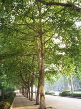 London Plane769 yd
Explorer Tom London Plane in Dublin thinks tourists from the city are just noisy children who don't know how to appreciate shade.…
More historic places in County Dublin · All of County Dublin

What do you know about this place?Tap to add a comment or ask a question