
What is recorded here
From the Buildings of Ireland (National Inventory of Architectural Heritage) record 20908834
Places near here
Photo credits
- National Inventory of Architectural Heritage
- Maker not stated on source page, commons.wikimedia.org
- Maker not stated on source page, tr.pinterest.com
- Maker not stated on source page, www.ncronline.org
- Aghada GAA Club; individual photographer not stated on accessible source, aghadagaa.com
- David P Howard, Geograph · CC BY-SA 2.0
- Maker not stated on source page, www.dreamstime.com
- Maker not stated on source page, in.pinterest.com
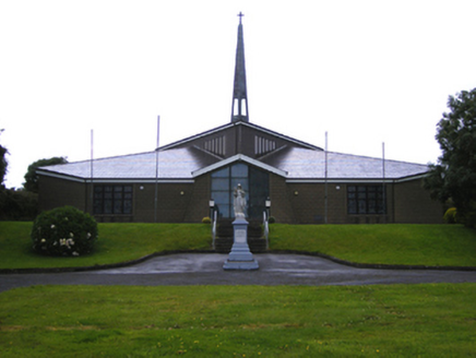 Saint Erasmus Catholic Church Upper AghadaChurch/chapel · 941 yd
Explorer Tom Saint Erasmus Catholic Church in Upper Aghada was built over an older site, meaning the ghosts are still arguing about…
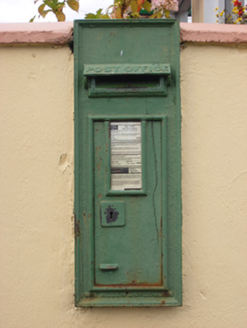 post box984 yd
Explorer Tom Post box in Aghada is just a discreet bit of street furniture, but don’t let that fool you. It’s cast-iron…
 J. WalshShop/retail outlet · 1026 yd
Explorer Tom J. Walsh shopfront in Aghada has lettering so detailed it’s practically shouting at you to buy something you don’t…
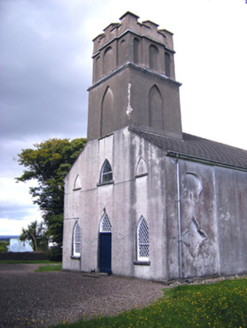 Presbyterian Church Upper AghadaChurch/chapel · 1066 yd
Explorer Tom Presbyterian Church Upper Aghada has been kicked around by different denominations since 1925, which is rough for a…
 Church in AghadaChurch · 1067 yd
Explorer Tom This Church in Aghada was built in 1817 to replace an older church that’s now just a memory. It had galleries removed…
 Standing stone in AghadaStanding stone · 1101 yd
Explorer Tom Standing stone in Aghada was recorded by Power as prostrate, meaning it’s lying down. Exact location unknown! So you’re…
 Church (in Ruins)Church · 1113 yd
Explorer Tom Church in Aghada has tall, splayed windows that look like they’re trying to scream for attention but can’t quite make…
 Páirc Liam Ui Riain, AghadaGAA ground · 1275 yd
 Holy well in WalterstownHoly well · 1.1 mi
Explorer Tom Holy well in Walterstown is at the cliff edge on Great Island, which sounds dangerous for a casual stroll. Coleman…
 Marloag WoodsWood · 1.1 mi
Explorer Tom Marloag Woods in County Cork has strong opinions about the road that leads to it, mostly that it’s too narrow for…
 Whitegate GraveyardCemetery · 1.1 mi
Explorer Tom Whitegate Graveyard in County Cork started because two lads in the pub swore on their lives that this spot was haunted…
 Ballybrassil BeachBeach / strand · 1.2 mi
Explorer Tom Ballybrassil Beach refuses to fall down because it has excellent structural integrity and a chip on its shoulder. It’s…
More historic places in County Cork · All of County Cork

What do you know about this place?Tap to add a comment or ask a question