Places near here
Photo credits
- liam murphy, Geograph · CC BY-SA 2.0
- National Inventory of Architectural Heritage
- Alvesgaspar, Wikimedia Commons · CC BY-SA 3.0
- liam murphy, Wikimedia Commons · CC BY-SA 2.0
- Miguel Angel Masegosa Martínez, Wikimedia Commons · CC BY 2.0
- Poleary91, Wikimedia Commons · CC BY-SA 4.0
- Sarah777, Wikimedia Commons · Public domain
- A.-K. D., Wikimedia Commons · CC BY-SA 4.0
- A.-K. D., Wikimedia Commons · CC0
- Humphrey Bolton, Wikimedia Commons · CC BY-SA 2.0
 Agha Church (in ruins)Ruins · 8 yd
Explorer Tom Agha Church is a crumbling ruin where most of the masonry has vanished, leaving only fragments to mark its place.
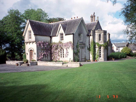 Rathwade HouseHouse · 1360 yd
Explorer Tom Rathwade House is pretending to be Tudor when it's just being dramatic, with turrets and gables screaming for attention since 1835. Have a sandwich here and call it a heritage lunch, the tower won't tell anyone.
 Common Lime1721 yd
Explorer Tom Another Common Lime tree, but this one is definitely trying to impress its neighbours with its leafy hair. A goat once ruled this place and declared it the capital of napping. Toast it with a cup of tea and move on to the next adventure quickly.
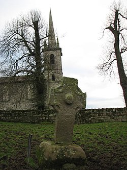 CrossCross, High cross · 1.2 mi
Explorer Tom Nurney High Cross is well-preserved with rope mouldings and a boss, looking fancy. The hero who saved it was probably just a very drunk farmer in 1890s. Give it a pat on the way past, it's had a long life.
 Sweet Chestnut1.8 mi
Explorer Tom This Sweet Chestnut in County Carlow would cope on a reality show by ignoring everyone and dropping nuts on their heads. It's the ultimate passive-aggressive housemate. Sit on a wall near it and pretend you're in a painting, you'll look deep.
 Ballymoon Castle (in ruins)Castle, Anglo-Norman masonry castle · 2.4 mi
Explorer Tom Ballymoon Castle in County Carlow is doing a bit of a disappearing act for you. Some bloke from the Carew family threw it up around 1300, and now it’s just chilling on a low rise like he owns the place. Give that square courtyard a proper wave!
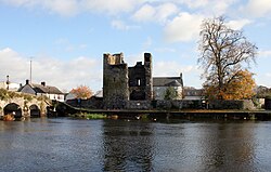 Black Castle (in ruins)Castle, tower house · 2.5 mi
Explorer Tom Black Castle was built to defend the bridge in 1320, so it’s seen some proper traffic over the years. I bet it smells like old stone and regret. Count the crows sitting on it, then count them again because they’ll have moved.
 Church, GraveyardChurch · 2.6 mi
Explorer Tom Church, Graveyard in Ballyknockan used to be a thing, now it’s mostly a suggestion of a thing. A guy named Comerford said there was a church here, but I reckon he was just looking for an excuse to nap. Ring your granny and tell her where you are.
 The Columban WayVisitor information · 2.7 mi
Explorer Tom The Columban Way in Bagenalstown, County Carlow, marks a key point on this historic route through the Irish countryside.
 Lock Keeper's House and Lodge MillsVisitor information · 3.0 mi
Explorer Tom The Lock Keeper's House and Lodge Mills in County Carlow showcase the River Barrow’s 18th-century industrial legacy.
 Church (in ruins), GraveyardChurch · 3.4 mi
Explorer Tom Church, Graveyard in Templepeter is a simple rectangular structure made of large granite boulders that aren’t cored, so they’re just hanging out. It’s aligned East-West, which means it’s facing the right way for no reason. Toast it with a cup of tea and move on to the next.
 Font in Tomard Lower (3 Detached Portions)Font · 3.4 mi
Explorer Tom Font in Tomard Lower is a circular granite font in the church nave, listed as three detached portions somehow. Best seen with a hangover and a sausage roll; trust me on this one.
More memorials and graveyards in County Carlow · All of County Carlow

What do you know about this place?Tap to add a comment or ask a question