Detached multiple-bay two-storey former union workhouse, dated 1842, on H-shaped plan having two advanced three-storey gable-fronted blocks to either end of the main (north) and rear (south) elevations, and with four-storey flat-roofed towers (on square-plan) attached to rear (south) adjacent to projecting blocks.…
Read the whole record
Detached multiple-bay two-storey former union workhouse, dated 1842, on H-shaped plan having two advanced three-storey gable-fronted blocks to either end of the main (north) and rear (south) elevations, and with four-storey flat-roofed towers (on square-plan) attached to rear (south) adjacent to projecting blocks. Later in use as a hospital and then as a nursing home (since 1973) with later single- and two-storey additions to the rear (south). Original building now largely out of use and derelict. Pitched natural slate roofs with clay ridge tiles, cement rendered chimneystacks to main block with stepped caps, and having remains of cast-iron rainwater goods. Roof now failing with slates missing in places. Raised cut limestone coping over gabled bays with moulded kneeler stones at eaves level. Stepped cut limestone coping to parapets of towers. Squared and roughly dressed coursed limestone and snecked limestone walls with flush dressed limestone quoins to the corners and having chamfered cut limestone plinth course to the main (north) elevation. Cement rendered finish to rear elevation (south) in places. Square-headed window openings with stone sills and roughly dressed limestone surrounds. Remains of two-over-two pane timber sliding sash windows and timber windows with timber mullions and transoms and leaded diamond-pane windows (ground floor of front elevation) to main body of building (both main and rear elevations) with stone later replacements. Square-headed window openings to the advanced gabled bays having tripartite windows with timber mullions and transoms and with leaded diamond-pane windows. Some windows now blocked and/or infilled. Narrow pointed-arch ventilation openings at attic level to gabled end bays to both front (north) and rear south) elevations having chamfered ashlar limestone surrounds; openings now blocked. Square-headed window openings to side elevations (east and west) having remains of eight-over-eight pane timber sliding sash windows. Square-headed window openings to tower at fourth-storey level having tripartite windows with cut stone mullions and transoms, and remains of leaded diamond-pane windows. Central Tudor-arched/four-centred arched door opening to main elevation (north) having chamfered ashlar limestone surround, half-glazed timber double doors and having pitched canopy porch over with natural slate roof and decorative timber bargeboards. Square-headed doorways elsewhere to site with variety of timber sheeted and modern doors. Round-headed doorways to rear elevations of towers (south) having cut stone voussoirs and timber sheeted doors. Early fabric retained to interior. Set back from road in extensive grounds to the south of Ballyshannon town centre. Yards to front and rear of site. Former workhouse administration block (40852075) adjacent to the north. Coursed rubble stone boundary walls to site.
Despite years of derelict and recent extensions to the rear, this substantial and well-detailed former union workhouse building retains its early character, form and much of its salient fabric. It is well-built in a Tudoresque style with some good quality cut limestone detailing particularly to the main (north) elevation. Of particular interest is the survival of much of its early fabric to the interior, which is a rare survival. The attractive design belies its intended grim institutional use and the fate suffered by many of its occupants. The tall, almost prison-like four-storey towers are an interesting feature that is not found at many workhouses, and which adds to the imposing nature of this structure. This structure was built to the standard union workhouse administration block design prepared by George Wilkinson (1814 - 90), architect to the Poor Law Commissioners in Ireland from 1839 until 1855 and who was responsible for the design and erection of all 130 workhouses that were built in Ireland (although Wilkinson was later responsible for 30 extra workhouses that were later built during the height of the Famine, albeit to a slightly more utilitarian design). Many workhouses were later converted for new uses (such as hospitals, as is the case here) and have been substantially altered over the years; and many were subsequently demolished during the twentieth century. At Ballyshannon, however, much of the original detailing survives making this building an important surviving example of its type. The workhouse at Ballyshannon was originally designed to accommodate 5-600 inmates (estimates vary), at a cost of £5,850 for the building and £1,100 for the fittings. The contractor involved was a Mr. Creden. It officially opened on the 6th of May 1843. It was one of seven workhouses constructed in County Donegal along with those at Donegal Town, Dunfanaghy, Glenties, Inishowen, Letterkenny and Milford. Although designed for 5-600 inmates, close to 1,000 were accommodated at Ballyshannon Union Workhouse during the height of the Great Famine. Workhouses are historically linked with the Great Famine (1845 - 1851) and are an important physical reminder of this traumatic period in Irish history. This structure (and ancillary buildings) forms part of a largely intact former union workhouse complex along the former workhouse administration block (40852075) adjacent to the north and the associated workhouse graveyard (located to the west of St. Anne’s Church of Ireland church), and is an integral element of the social history and built heritage of County Donegal. Sensitively restored, this building would constitute an important element of the heritage of Ireland, and make a strongly positive contribution to Ballyshannon. A workhouse fever hospital was also built to the north-east of the workhouse at Ballyshannon in 1847 but is no longer extant (it was on the site now occupied by a secondary school).
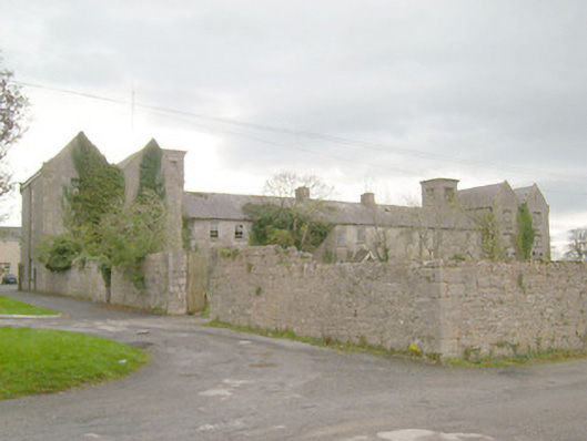
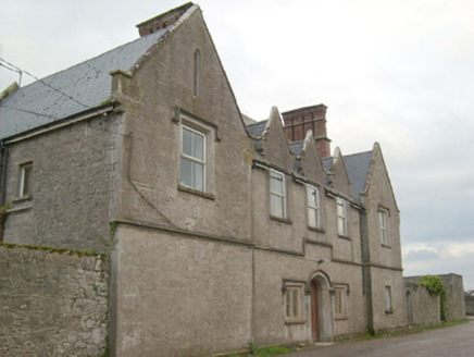 workhouse, workhouse administration block50 yd
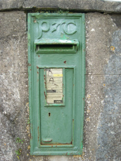 post box85 yd
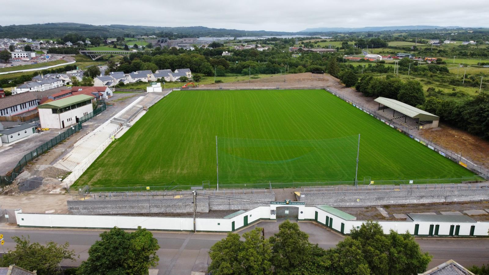 Father Tierney ParkGAA ground · 122 yd
 Melly’s BarPub · 333 yd
 McIntyre’s Saloon BarPub · 444 yd
 Rory GallagherMemorial · 476 yd
 BallyshannonHistoric town · 489 yd
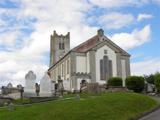 St Anne's Church GraveyardGraveyard · 572 yd
 Standing stone in Townparks (ballyshannon Ed)Standing stone · 811 yd
 Wardtown StrandBeach / strand · 1.9 mi
 Tullan StrandBeach / strand · 2.2 mi
 Dark Cliffs at KilbarronPublicly named cliff or headland · 3.3 mi
What do you know about this place?Tap to add a comment or ask a question