
What is recorded here
From the Northern Ireland Sites and Monuments Record record FER211:187
Places near here
Picture notes
- Computer-made picture. It does not show this monument.
- N Chadwick, Wikimedia Commons · CC BY-SA 2.0
- Colin Park, Geograph · CC BY-SA 2.0
- Kenneth Allen, Wikimedia Commons · CC BY-SA 2.0
- Computer-made picture. It does not show this playground.
- Raymond Millar, Wikimedia Commons · CC BY-SA 2.0
- Kenneth Allen, Geograph · CC BY-SA 2.0
- Dean Molyneaux, Wikimedia Commons · CC BY-SA 2.0
- N Chadwick, Geograph · CC BY-SA 2.0
 Settlement: cherry island in CornagradeSettlement: Cherry Island · 208 ydComputer-made picture
Explorer Tom Settlement: cherry island in Cornagrade sounds like a fruit-themed village that forgot to bring the actual cherries. I reckon it took about four hundred cups of tea to figure out where the door actually was. It's the kind of place that makes a dull Tuesday feel suspiciously adventurous and slightly damp.
 Prehistoric occupation site in TonystickPrehistoric Occupation Site · 303 ydComputer-made picture
Explorer Tom Prehistoric occupation site in Tonystick is where people lived so long ago they’d be the life of any wedding party, dancing all night. It’s been an occupation site for so long it’s practically a permanent resident. Bring your own legend, I’ve run out of good ones to share with you.
 The Butter MarketMarket · 359 yd
Explorer Tom The Butter Market in County Fermanagh is basically a giant refrigerator that refuses to admit it’s just selling dairy products. It has an imaginary fan club that probably meets on Tuesdays to critique the cheddar quality. Bring your worst joke, the place has heard worse from angry farmers.
 C18th church with C17th tower, & graveyard: enniskillen church in EnniskillenC18th Church with C17th Tower, & Graveyard: Enniskillen Church · 424 yd
Explorer Tom C18th church with C17th tower, & graveyard: Enniskillen church in Enniskillen wants to lose weight before the next century. Go in good boots and better humour.
 St. Macartin's CathedralChurch · 425 yd
Explorer Tom St. Macartin's Cathedral in County Fermanagh is doing its best 'mysterious old wise man' impression while everyone else is just staring at it. Honestly, if I were a Grade A listed building, I’d be charging for entry by now. Perfect spot to practise your best tour-guide voice and sound like you invented the word history.
 Railway MuseumMuseum · 458 yd
 Children's playground524 ydComputer-made picture
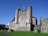 Siege of EnniskillenSiege · 531 yd
Explorer Tom Siege of Enniskillen would describe itself to a stranger as 'a bit of a squeeze, but we held on.' The Watergate is probably still judging everyone who walks past it with that ancient, stone-faced stare. Take the long way round, it deserves the effort.
 Boer War MemorialMemorial · 591 yd
 Remembrance Day bombingBomb attack · 613 yd
Explorer Tom Remembrance Day bombing would cope on a reality show by having the most dramatic slow-motion exit you've ever seen. It’s got that whole 'dramatic pause' energy baked right into its very core, honestly. Ten minutes here and you'll have a yarn for the pub.
 Enniskillen castle in EnniskillenEnniskillen Castle · 658 yd
Explorer Tom Enniskillen castle is sitting on the Erne like a king who lost his crown. I once saw a fox take charge here and honestly, he did a better job than most mayors. It's free, it's odd, what more do you want?
 Castle IslandIslet · 867 yd
More archaeology and monuments in County Fermanagh · All of County Fermanagh

What do you know about this place?Tap to add a comment or ask a question