
What is recorded here
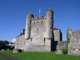
The Butter Market in Enniskillen puts a time limit on the great Irish art of arguing over a price. Hold out long enough and you haven't bought cheaper butter; you've rented a puddle.
Current recorded use: Market.
From the Northern Ireland Historic Buildings Record record HB12/17/059
The official record and map point do not grant access. Many historic buildings are privately owned; view them only from public ground unless the owner allows entry.
Places near here
Photo credits
- Colin Park, Geograph · CC BY-SA 2.0
- N Chadwick, Wikimedia Commons · CC BY-SA 2.0
- Kenneth Allen, Wikimedia Commons · CC BY-SA 2.0
- Raymond Millar, Wikimedia Commons · CC BY-SA 2.0
- Dean Molyneaux, Wikimedia Commons · CC BY-SA 2.0
- Kenneth Allen, Geograph · CC BY-SA 2.0
- N Chadwick, Geograph · CC BY-SA 2.0
 C18th church with C17th tower, & graveyard: enniskillen church in EnniskillenC18th Church with C17th Tower, & Graveyard: Enniskillen Church · 151 yd
 St. Macartin's CathedralChurch · 153 yd
 Bank Of IrelandBank · 230 ydRailway MuseumMuseum · 234 ydCherry IslandIsland · 272 yd
 Siege of EnniskillenSiege · 341 yd
 Remembrance Day bombingBomb attack · 359 yd
 Boer War MemorialMemorial · 368 yd
 Cole's MonumentMonument · 407 yd
 Enniskillen castle in EnniskillenEnniskillen Castle · 446 ydEnniskillen CastleCastle · 473 yd
 Castle IslandIslet · 597 yd
More historic places in County Fermanagh · All of County Fermanagh
What do you know about this place?