What is recorded here
A windmill is marked on the Down Survey parish map of Rosslare in NLI (ms, 725; microfilm, P 7384; N 6380) at Ballybroe, and the terrier or commentary lists a windmill at Ballybroe and Drumagh as well as a windmill at Whitehouse (WX043-010----). James Keating owned 22 acres in the combined townland of Ballybroe and Drumagh in 1640 according to the Book of Survey and Distribution (1660s) (Simington 1953, 307). A functioning windmill is marked on the 1839 ed. of the OS 6-inch map at Drimagh, which is a northern extension of Ballybro townland. The location is a level, relatively high area with the ground sloping down to the S, but there is no evidence of a windmill at the centre of a roundabout on a housing estate.
A windmill is marked on the Down Survey parish map of Rosslare in NLI (ms, 725; microfilm, P 7384; N 6380) at Ballybroe, and the terrier or commentary lists a windmill at Ballybroe and Drumagh as well as a windmill at Whitehouse (WX043-010----). James Keating owned 22 acres in the combined townland of Ballybroe and Drumagh in 1640 according to the Book of Survey and Distribution (1660s) (Simington 1953, 307). A…
From the National Monuments Service (Archaeological Survey of Ireland) record WX048-159
The monument record does not grant public access. Check the route and ask the landowner before entering private land.
- What survives
- Recorded monument
Places near here
Photo credits
- National Inventory of Architectural Heritage
- Bob Embleton, Wikimedia Commons · CC BY-SA 2.0
- DeFacto, Wikimedia Commons · CC BY-SA 4.0
- User Ali-oops on en.wikipedia, Wikimedia Commons · GFDL
- Cozzmick, Wikimedia Commons · CC BY-SA 4.0
- Sheila1988, Wikimedia Commons · CC BY-SA 4.0
- Jean-Pol GRANDMONT, Wikimedia Commons · CC BY 3.0
- Danielclauzier, Wikimedia Commons · CC BY-SA 3.0
- AFBorchert, Wikimedia Commons · CC BY-SA 4.0
 bridge611 ydBirdlife of RosslareVisitor information · 1147 yd
 Rosslare Strand Railway StationRailway station · 1192 ydSt. Michaels WellHoly well · 1719 ydMarconi HouseMemorial · 1.0 mi
 Windmill (Corn) (Disused)Windmill · 4.0 mi
 Carne BeachBeach / strand · 4.6 mi
 CastleCastle, tower house · 4.7 mi
 Irish Agricultural MuseumMuseum · 5.4 mi
 American Sweetgum5.4 mi
 Sack of WexfordSiege · 5.8 mi
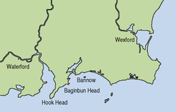 Siege of WexfordSiege · 5.8 mi
More archaeology and monuments in County Wexford · All of County Wexford
What do you know about this place?