
More pictures of this place


What is recorded here
Places near here
Photo credits
- National Inventory of Architectural Heritage
- Maker not stated on source page, www.flickr.com
- Maker not stated on source page, au.pinterest.com
- Maker not stated on source page, en.wikipedia.org
- Nmwood189, Wikimedia Commons · CC BY-SA 4.0
- Dr Wotsit, Wikimedia Commons · CC BY-SA 3.0
- Enjoy Irish Culture; photographer not stated, Enjoy Irish Culture
- Maker not stated on source page, www.pinterest.com
- Maker not stated on source page, br.pinterest.com
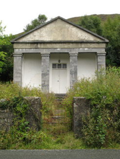 Maum CourthouseCourt house · 922 yd
Explorer Tom Maum Courthouse wants to resolve to stop judging everyone who walks past its temple front. It’s all dressed up in…
 Fairy fort / stone ringfort in An Mám ThiarFairy fort / stone ringfort · 1589 yd
Explorer Tom Fairy fort / stone ringfort in An Mám Thiar is perched up high, watching the valley like it owes them money. After a…
 Ric barracks1737 yd
Explorer Tom RIC barracks in Teernakill North is derelict but still thinks it has authority, which is a bit much for a building. Its…
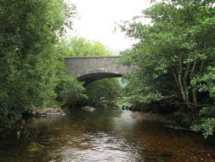 Teernakill BridgeBridge · 1.1 mi
Explorer Tom Teernakill Bridge sits nestled in trees looking all modest while secretly showing off its solid stone bones. Rumor has…
 Stone row in Cromghlinn Thoir,cromghlinn ThiarStone row · 1.2 mi
Explorer Tom Stone row in Cromghlinn Thoir and Thiar sounds like a line of people waiting for a bus that never comes. The name…
 Breenane GraveyardGraveyard · 1.8 mi
Explorer Tom Breenane Graveyard is where Vikings supposedly got lost looking for it because they couldn't read the map or the trees.…
 CastlekirkCastle · 2.4 mi
Explorer Tom Castlekirk is called Hen's Castle, and no, I did not name it after my poultry empire. The ruin stands on a tiny…
 LackavreaMountain / peak · 2.4 mi
Explorer Tom Lackavrea rises between Lough Corrib and the Maamturks, a Galway summit that seems to have hired every bog in Connemara…
 CorcogemoreMountain / peak · 2.9 mi
Explorer Tom Corcogemore sits at the southern end of Galway’s Maamturk Mountains, looking as if someone set a great stone beehive…
 Joyce Country SheepdogsHeritage attraction · 4.2 mi
Explorer Tom At Joyce Country Sheepdogs near Shanafaraghaun, a Border Collie can make a hillside full of Connemara Blackface sheep…
 Heath IslandIslet · 5.7 mi
Explorer Tom Heath Island is where a love story went badly wrong because one partner got tangled in the heather and the other…
 Carrigeenfair IslandIslet · 5.7 mi
Explorer Tom Carrigeenfair Island is named after a fair but the map makers got it wrong because they thought ‘fair’ meant ‘pretty’…
More walking routes in County Galway · All of County Galway

What do you know about this place?Tap to add a comment or ask a question