What is recorded here
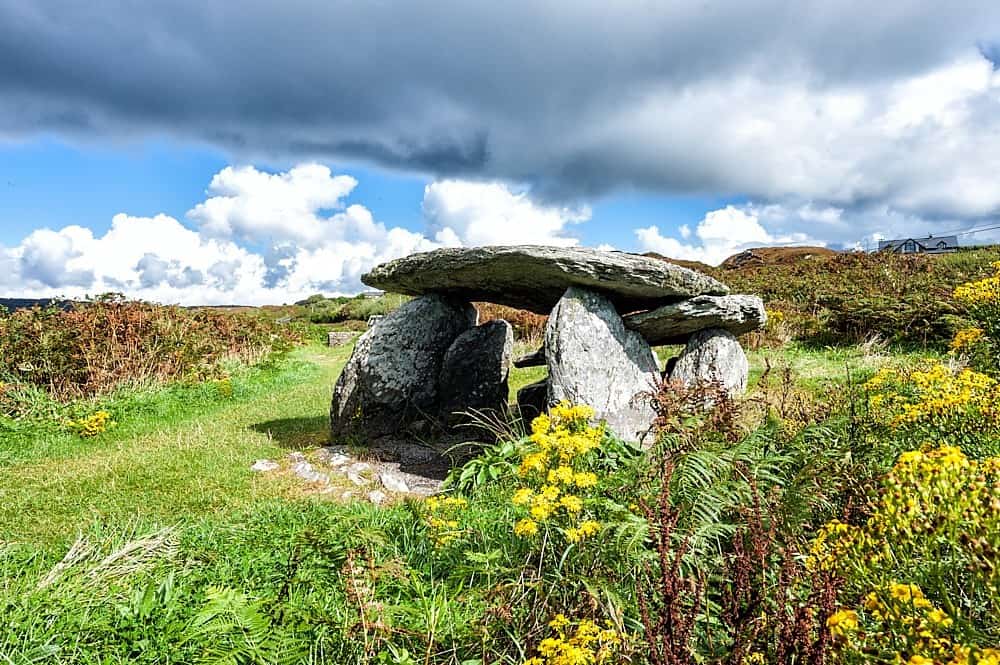
Situated at the crest of a W-facing slope. A large upright stone (L 2.5m; T 0.1m at W to 0.3m at E; H 1-1.1m) oriented NE-SW forms the SE side of a chamber only represented by two small earthfast stones (dims 0.6m NW-SE; 0.4m NE-SW; H 0.7m: 0.8m NE-SW; x 0.1m; max. H 0.3m) 1.6m distant to the NW.
The above description is derived from the published 'Archaeological Inventory of County Monaghan' (Dublin: Stationery Office, 1986). In certain instances the entries have been revised and updated in the light of recent research.
Compiled by: Michael Moore
Date of revision: 1 December 2016
Wedge tomb, dating to the Late Neolithic or Early Bronze Age (c. 2500–1000 BC). Its partial survival reflects the typical megalithic burial tradition of the region, with the orientation and positioning suggesting ritual or symbolic alignment.
The monument record does not grant public access. Check the route and ask the landowner before entering private land.
- What survives
- Recorded monument
Places near here
 Giants GreveWedge tomb · 1024 yd
 Stranoodan fortFairy fort / earthen ringfort · 1072 yd
 Saint Michael's Catholic Churchchurch/chapel · 1575 yd
 post boxpost box · 1608 yd
 Rossmore MausoleumHeritage attraction · 2.2 mi
 Dagda's CauldronHeritage attraction · 2.4 mi
 Hazel WoodWood · 3.4 mi
 Lisarrilly HillMountain / peak · 3.9 mi
 Roosky Castle (Site of)Castle, ringwork · 4.4 mi
 Bawn in Roosky (monaghan By., Monaghan Par.)Bawn · 4.5 mi
 Rossmore MonumentMemorial · 4.6 mi
 Tomb HillMountain / peak · 5.3 mi
Other information
Photo: Credit not shown in the picture search · Rights wording not checked; contact us if this picture should be removed