What is recorded here
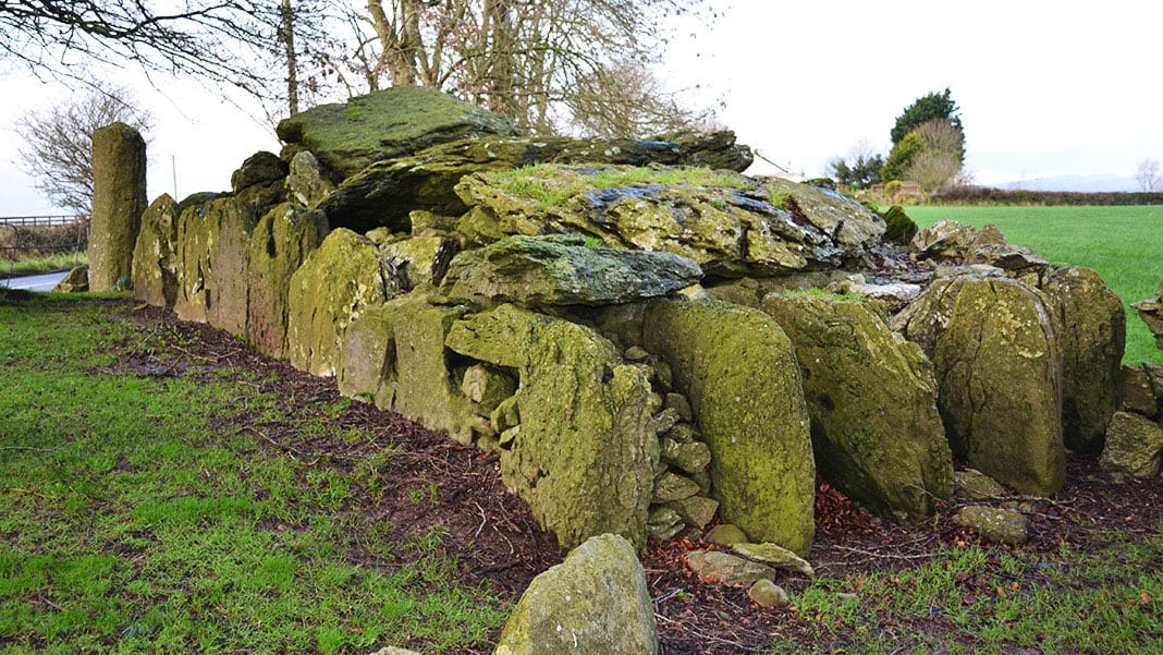
Ruined gallery, 1.15 m wide, aligned NW-SE at the west foot of a rocky ridge in Carrigboy. Two side stones, a west facade stone and three outer-wall stones still mark the chamber, with faint traces of its mound beside them. People may have laid out the dead there beneath an open sky, then covered the work in earth until the ridge itself seemed to hold them.
Situated at W foot of ridge of outcropping rock. Ruined gallery (Wth 1.15m to W), aligned NW-SE, represented by two side stones and facade stone to W, and three outer-wall stones along N and S sides. Traces of mound around tomb.
The above description is derived from the published 'Archaeological Inventory of County Cork. Volume 3: Mid Cork' (Dublin: Stationery Office, 1997). In certain instances the entries have been revised and updated in the light of recent research.
Date of upload/revision: 14 January 2009
Wedge tomb, dating to the Late Neolithic or Early Bronze Age (c. 2500–1000 BCE). Its partial survival, including the facade and alignment, reflects a regional megalithic tradition in west Munster.
The monument record does not grant public access. Check the route and ask the landowner before entering private land.
- What survives
- Recorded monument
Places near here
 IndicatedKiln, lime · 442 yd
 Kill Burial Gd (Disused)Burial ground · 652 yd
 TobernakillaHoly well · 748 yd
 Carrigboy Castlehouse · 1092 yd
 Kilmichael Ambush SiteMonument · 1.3 mi
 Kilmichael Ambushambush · 1.4 mi
 Dromcarra Castle (in Ruins)Castle, tower house · 2.5 mi
 Castle (Site of)Castle, unclassified · 3.0 mi
 The Gearagh Nature ReserveNature reserve · 4.4 mi
 Castle RockNamed rock · 4.5 mi
 Summerhouse WoodForest · 5.1 mi
 Gortnahoughtee Mass RockNamed rock · 5.8 mi
Other information
Photo: Credit not shown in the picture search · Rights wording not checked; contact us if this picture should be removed