What is recorded here
Near head of small valley on S side Beara peninsula, overlooking Bantry Bay. Wedge-shaped gallery (L c. 3m; Wth 1.5m at W end, 1m at E) aligned ENE-WSW. Two sidestones supporting single roof stone represent its E end. Two low overlapping stones, set in line with the N side stone, indicate that gallery extended to W. Roofed portion decreases in height from W to E. Tomb incorporated in low mound, 10.5m by 7.5m. (de Valera and O Nualláin 1982, 34-5, Co. 50)
The above description is derived from the published 'Archaeological Inventory of County Cork. Volume IV. Counties Cork, Kerry, Limerick, Tipperary. (Dublin: Stationery Office, 1982)
Near head of small valley on S side Beara peninsula, overlooking Bantry Bay. Wedge-shaped gallery (L c. 3m; Wth 1.5m at W end, 1m at E) aligned ENE-WSW. Two sidestones supporting single roof stone represent its E end. Two low overlapping stones, set in line with the N side stone, indicate that gallery extended to W. Roofed portion decreases in height from W to E. Tomb incorporated in low mound, 10.5m by 7.5m. (de…
From the National Monuments Service (Archaeological Survey of Ireland) record CO103-014
The monument record does not grant public access. Check the route and ask the landowner before entering private land.
- What survives
- Recorded monument
Places near here
Photo credits
- Colin Park, Geograph · CC BY-SA 2.0
- National Inventory of Architectural Heritage
- John M, Geograph · CC BY-SA 2.0
- Adriaen van Diest, Wikimedia Commons · Public domain
- Jeff Buck, Geograph · CC BY-SA 2.0
- Peter Craine, Wikimedia Commons · CC BY-SA 2.0
- Mike Dickison, Wikimedia Commons · CC BY 4.0
Enclosure in BallynahownEnclosure · 182 ydField boundary in Crooha EastField boundary · 307 yd Sugarloaf Mountain West TopMountain / peak · 1.5 miSugarloaf MountainMountain / peak · 2.0 miHungry Hill GalleryGallery · 2.1 miSt. Fachtna's Roman Catholic ChurchChurch/chapel · 2.3 miAdrigole HouseRectory/glebe/vicarage/curate's house · 2.3 miGarinish WestIslet · 3.5 miBattle of Bantry BayMajor battlefield · 4.2 miMare's Tail WaterfallViewpoint · 4.3 miGlengarriff WoodsWood · 5.3 miNew Zealand broadleaf6.4 mi
 Sugarloaf Mountain West TopMountain / peak · 1.5 mi
 Sugarloaf MountainMountain / peak · 2.0 miHungry Hill GalleryGallery · 2.1 mi
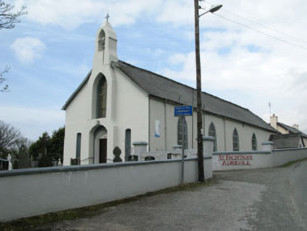 St. Fachtna's Roman Catholic ChurchChurch/chapel · 2.3 mi
 Adrigole HouseRectory/glebe/vicarage/curate's house · 2.3 mi
 Garinish WestIslet · 3.5 mi
 Battle of Bantry BayMajor battlefield · 4.2 mi
 Mare's Tail WaterfallViewpoint · 4.3 mi
 Glengarriff WoodsWood · 5.3 mi
 New Zealand broadleaf6.4 mi
More archaeology and monuments in County Cork · All of County Cork
What do you know about this place?