What is recorded here
In rough hill pasture part of which is cutaway bog, on a terrace, on a S-facing hillslope with a view E-W over Trafrask Harbour and Bantry Bay. A relict stone field boundary (T 0.5m; H 0.4m), which protrudes above the surface of the remaining shallow bog, runs in a general N direction for c. 70m and then continues intermittently in an E direction for c. 60m towards the river forming the boundary between Crooha East and Ballynahown. Occasionally the wall runs on into deeper bog. Most of the stones are set at right angles to the line of the wall and the larger slabs are set on the line of the wall. Volume 5' (Dublin: Stationery Office, 2009).
In rough hill pasture part of which is cutaway bog, on a terrace, on a S-facing hillslope with a view E-W over Trafrask Harbour and Bantry Bay. A relict stone field boundary (T 0.5m; H 0.4m), which protrudes above the surface of the remaining shallow bog, runs in a general N direction for c. 70m and then continues intermittently in an E direction for c. 60m towards the river forming the boundary between Crooha…
From the National Monuments Service (Archaeological Survey of Ireland) record CO103-029
The monument record does not grant public access. Check the route and ask the landowner before entering private land.
- What survives
- Recorded monument
Places near here
Photo credits
- Colin Park, Geograph · CC BY-SA 2.0
- National Inventory of Architectural Heritage
- John M, Geograph · CC BY-SA 2.0
- Jeff Buck, Geograph · CC BY-SA 2.0
- Adriaen van Diest, Wikimedia Commons · Public domain
- Peter Craine, Wikimedia Commons · CC BY-SA 2.0
- Mike Dickison, Wikimedia Commons · CC BY 4.0
Enclosure in BallynahownEnclosure · 291 ydWedge tomb in BallynahownWedge tomb · 307 yd Sugarloaf Mountain West TopMountain / peak · 1.6 miHungry Hill GalleryGallery · 2.1 miSugarloaf MountainMountain / peak · 2.1 miAdrigole HouseRectory/glebe/vicarage/curate's house · 2.2 miSt. Fachtna's Roman Catholic ChurchChurch/chapel · 2.2 miGarinish WestIslet · 3.7 miMare's Tail WaterfallViewpoint · 4.1 miBattle of Bantry BayMajor battlefield · 4.2 miGlengarriff WoodsWood · 5.4 miNew Zealand broadleaf6.2 mi
 Sugarloaf Mountain West TopMountain / peak · 1.6 miHungry Hill GalleryGallery · 2.1 mi
 Sugarloaf MountainMountain / peak · 2.1 mi
 Adrigole HouseRectory/glebe/vicarage/curate's house · 2.2 mi
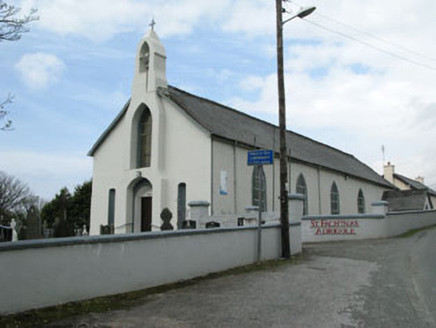 St. Fachtna's Roman Catholic ChurchChurch/chapel · 2.2 mi
 Garinish WestIslet · 3.7 mi
 Mare's Tail WaterfallViewpoint · 4.1 mi
 Battle of Bantry BayMajor battlefield · 4.2 mi
 Glengarriff WoodsWood · 5.4 mi
 New Zealand broadleaf6.2 mi
More archaeology and monuments in County Cork · All of County Cork
What do you know about this place?