What is recorded here
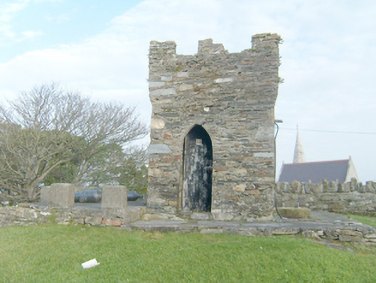
Freestanding single-bay single-storey turret (on square plan), built c. 1840. Crenellated parapet with machicolations. Rubble stone walls, now partially cement rendered. Pointed-arched opening to west having timber sheeted door and square-headed window opening to north, now blocked. Infilled opening to the south. Set on raised rubble stone plinth having cement rendered bollards and two cannon to the north. Located on the top of Patrick’s Hill to the south-west of the centre of Dunfanaghy overlooking Sheephaven Bay to the north and north-east. Site (on sub triangular-plan) surrounded by rubble stone boundary wall. Pedestrian gateway to the west. Gable-fronted single-bay single-storey structure to the south having square-headed opening to the north elevation.
This curious small-scale turret crowns the top of Patrick’s Hill, overlooking Dunfanaghy to the north and west, and Sheephaven Bay to the north and north-east. It is robustly constructed using local rubble stone masonry. The crenellated parapet lends it a military or defensive character but its original function is not known. It does not appear to have been extant in c. 1834 (not depicted on Ordnance Survey first edition six-inch map) but it is indicated on the Griffith Valuation map of c. 1860. It may have been constructed in the early part of the nineteenth century as a lookout post over Sheephaven Bay; it may have been originally associated with a ‘waterguards station’ indicated to the north in c. 1834. This enigmatic turret is an attractive focal point in the streetscape\skyline of Dunfanaghy and is an integral element of the built heritage of the local area. The surrounding rubble stone boundary wall and the single-storey structure (function unknown) to the south add to the setting and context.
From the Buildings of Ireland (National Inventory of Architectural Heritage) record 40807024
This does not grant access. Most recorded buildings are privately owned; view them only from public ground unless the owner allows entry.
Places near here
 Dunfanaghy Presbyterian ChurchChurch/chapel · 73 yd
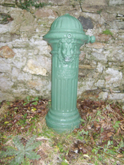 water pump165 ydCastle (Site of)Castle, unclassified · 226 yd
 Kill Old Church GraveyardGraveyard · 678 ydLockheed Hudson bomber 1942Memorial · 1004 yd
 KillahoeyOfficial bathing water · 1287 yd
 Local Wildlife presentationVisitor information · 1.0 mi
 CrocksheeMountain / peak · 1.8 mi
 CroaghnamaddyMountain / peak · 1.9 mi
 Ballymore Lower Tomb near DunfanaghyMegalithic tomb · 2.4 mi
 Horn Head Portal TombPortal tomb · 2.5 mi
 Templebreaga ArchNatural arch · 2.7 mi
Pictures: Andreas F. Borchert, Wikimedia Commons · CC BY-SA 4.0; National Inventory of Architectural Heritage; Ross, Wikimedia Commons · CC BY-SA 2.0; Kenneth Allen, Geograph · CC BY-SA 2.0; Chris Gunns, Geograph · CC BY-SA 2.0; Rossographer, Geograph · CC BY-SA 2.0; Rossographer, Wikimedia Commons · CC BY-SA 2.0; C Michael Hogan, Wikimedia Commons · CC BY-SA 2.0
More historic places in County Donegal · All of County Donegal
What do you know about this place?