
What is recorded here
Urquhart Priory is a priory in Moray, Scotland.
Places near here
Photo credits
- Maker not stated on source page, commons.wikimedia.org
- Richard Sutcliffe, Wikimedia Commons · CC BY-SA 2.0
- Maker not stated on source page, en.wikipedia.org
- Anne Burgess, Wikimedia Commons · CC BY-SA 2.0
- Maker not stated on source page, www.airbnb.ca
- Maker not stated on source page, www.flickr.com
- valenta, Wikimedia Commons · CC BY-SA 2.0
- thejackrustles, Wikimedia Commons · CC BY-SA 2.0
 Urquhart, Main Street, Former United Free ChurchChurch (19th Century) · 609 yd
 Urquhart StationPit(s), Rig and Furrow (medieval) - (post Medieval) · 647 yd
 Urquhart, Old Parish ChurchBurial Ground (medieval) - (post Medieval), Church (medieval) · 659 yd
 Elspet Lamb MemorialMemorial · 669 yd
 MaverstonBuilding · 765 yd
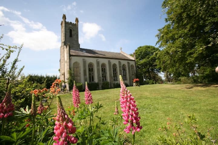 Urquhart Parish ChurchPolished Axehead (stone) · 835 yd
 Urquhart, War MemorialWar Memorial (20th Century) · 921 yd
 Sheepieshill WoodWood · 1432 yd
 Castle HillEarthwork, Motte (medieval) (possible) · 1.2 mi
 Innes HouseDovecot(s) (post Medieval), Formal Garden (post Medieval), Sundial(s) (post Medieval), Tower House (17th Century) · 1.4 mi
 Hill of MeftForest · 1.5 mi
 Lhanbryde War MemorialMemorial · 1.7 mi
More archaeology and monuments in Moray · All of Moray

What do you know about this place?Tap to add a comment or ask a question