What is recorded here
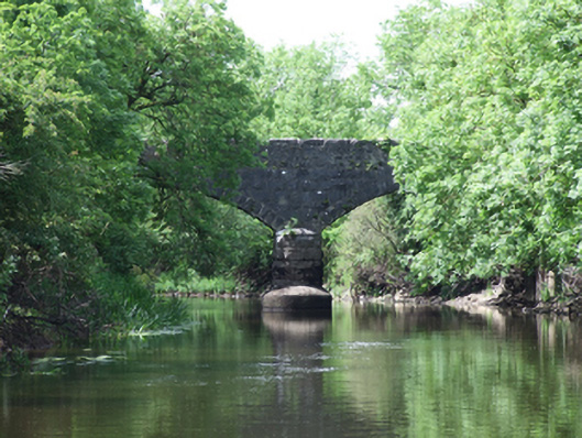
Double-arch sandstone bridge, built c.1860, spanning the Annalee River. Pier and abutments of rock-faced blocks in varying course heights. Bullnose centre pier with rounded head on both elevations, having wide concrete bullnosed base. Wide equal segmental-arched spans, arch soffit of coursed stone. Rock-faced spandrels and parapet above arch rings of regular voussoirs with dressed arris. Heavily rusticated rock-faced copings to parapets, sloped ends to south parapets.
A well-proportioned bridge of robust character that is a good example of nineteenth century stone bridge construction. The rock-faced masonry construction is clearly the work of skill stone masons. The design is almost identical to the nearby Baker's Bridge over the River Erne, suggesting that both were built as part of a Board of Works arterial drainage scheme for the improvement of the river and its tributaries. The bridge makes an important contribution to the historic character of Urney village.
From the Buildings of Ireland (National Inventory of Architectural Heritage) record 40401516
This does not grant access. Most recorded buildings are privately owned; view them only from public ground unless the owner allows entry.
Places near here
Photo credits
- National Inventory of Architectural Heritage
- Malene Thyssen, Wikimedia Commons · CC BY-SA 3.0
- Adam Simpson, Geograph · CC BY-SA 2.0
- Oliver Dixon, Wikimedia Commons · CC BY-SA 2.0
- Peter Gerken, Geograph · CC BY-SA 2.0
- Algirdas at Lithuanian Wikipedia, Wikimedia Commons · Public domain
- Kenneth Allen, Geograph · CC BY-SA 2.0
- NTF30, Wikimedia Commons · CC BY-SA 4.0
- Deadstar, Wikimedia Commons · CC BY-SA 4.0
DrumcalpinMountain / peak · 1499 yd Baker's BridgeBridge · 1.1 micreamery1.2 miEuropean Beech2.3 miClogh Oughter CastleCastle, Anglo-Norman masonry castle · 2.9 miDrumlane AbbeyHeritage attraction · 3.0 miRambling at Farnham EstateVisitor information · 3.2 miPedunculate Oak3.4 miCloughoughter CastleIsland castle ruin · 3.5 miMill WalkVisitor information · 4.0 miCourt tomb in GartnanoulCourt tomb · 4.4 miFin Mc Cools FingersStone row · 5.1 mi
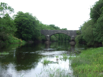 Baker's BridgeBridge · 1.1 mi
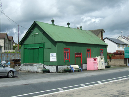 creamery1.2 mi
 European Beech2.3 mi
 Clogh Oughter CastleCastle, Anglo-Norman masonry castle · 2.9 mi
 Drumlane AbbeyHeritage attraction · 3.0 mi
 Rambling at Farnham EstateVisitor information · 3.2 mi
 Pedunculate Oak3.4 mi
 Cloughoughter CastleIsland castle ruin · 3.5 mi
 Mill WalkVisitor information · 4.0 mi
 Court tomb in GartnanoulCourt tomb · 4.4 mi
 Fin Mc Cools FingersStone row · 5.1 mi
More historic places in County Cavan · All of County Cavan
What do you know about this place?