What is recorded here
Map note: The map marks Uragh North Stone Circle as an ancient site in County Kerry, Ireland. There is no need to invent a lost kingdom to make the name interesting.
Uragh North Stone Circle is recorded as an archaeological place in County Kerry.
From OpenStreetMap (© OpenStreetMap contributors) n6722761435
Places near here
Photo credits
- Dieglop, Wikimedia Commons · CC BY-SA 4.0
- Espresso Addict, Geograph · CC BY-SA 2.0
- Espresso Addict, Wikimedia Commons · CC BY-SA 2.0
- Nigel Cox, Geograph · CC BY-SA 2.0
- Gordon Hatton, Geograph · CC BY-SA 2.0
- Ulrich Hartmann, Geograph · CC BY-SA 2.0
- Robotforaday at en.wikipedia, Wikimedia Commons · Public domain
- Mick Garratt, Geograph · CC BY-SA 2.0
- Colin Park, Wikimedia Commons · CC BY-SA 2.0
- Angela Herlihy, Geograph · CC BY-SA 2.0
- National Inventory of Architectural Heritage
- Keith Cunneen, Geograph · CC BY-SA 2.0
 Uragh Stone CircleArchaeological place · 509 yd
 Uragh WoodForest · 954 yd
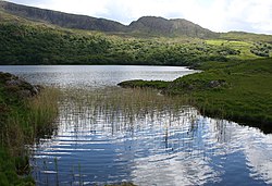 Uragh Wood Nature ReserveNature reserve · 1435 yd
 Gleninchaquin WaterfallWaterfall · 1.7 mi
 Ormond's IslandIslet · 2.7 mi
 Dinish IslandIslet · 2.8 mi
 Dromore CastleCastle · 3.2 mi
 Lackeen PointHeadland · 3.3 mi
 CahaMountain / peak · 3.3 mi
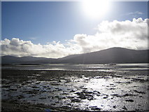 Coss StrandBeach / strand · 3.5 mi
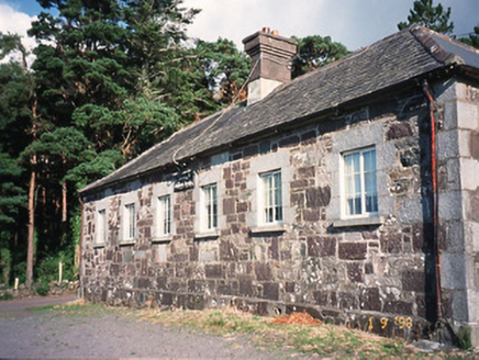 Dawros National SchoolSchool · 3.5 mi
Explorer Tom Dawros National School has a family tree that I’m pretty sure I just made up, involving great-aunts who taught maths badly. Built around 1860, it’s now disused and has an extension from the late twentieth century that looks confused. It probably still smells like chalk dust and regret. Perfect spot to practise your best tour-guide voice.
 Killane Mountain South-West TopMountain / peak · 3.5 mi
More archaeology and monuments in County Kerry · All of County Kerry

What do you know about this place?Tap to add a comment or ask a question