What is recorded here
Upper Victoria is a linear feature in Angus, Scotland.
Places near here
Photo credits
- Douglas Nelson, Wikimedia Commons · CC BY-SA 2.0
- Maigheach-gheal, Wikimedia Commons · CC BY-SA 2.0
- jamesnicoll, Wikimedia Commons · CC BY-SA 2.0
- Richard Webb, Wikimedia Commons · CC BY-SA 2.0
- Scott Cormie, Wikimedia Commons · CC BY-SA 2.0
- Peter O'Connor aka anemoneprojectors, Wikimedia Commons · CC BY-SA 2.0
- Ollie Lloyd, Wikimedia Commons · CC BY-SA 3.0
- Anne Burgess, Wikimedia Commons · CC BY-SA 2.0
- Milestone Society, Wikimedia Commons · CC BY-SA 2.0
 Mains of RavensbyPit(s) · 336 yd
 PitskellyEnclosure (possible), Rig and Furrow (medieval) - (post Medieval) · 357 yd
 Ravensby HouseCountry House · 552 yd
 BarryVillage · 1136 yd
 Panmure CastleCastle (medieval), Chapel (medieval), Garden (post Medieval) (possible), Moat (medieval), Mound(s) · 1.4 mi
 Castle HillCastle (medieval) (possible) · 1.4 mi
 Carnoustie War MemorialMemorial · 1.5 mi
 The Dibble TreeVisitor information · 1.5 mi
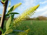 Dibble TreeCricket-bat willow · 1.5 mi
 Battle of BarryBattle · 1.6 mi
 Carnoustie BeachBeach / strand · 1.8 mi
 Camustane WoodWood · 1.9 mi
More archaeology and monuments in Angus · All of Angus

What do you know about this place?Tap to add a comment or ask a question