
What is recorded here
From OpenStreetMap (© OpenStreetMap contributors) n8707464220
Places near here
Photo credits
- National Inventory of Architectural Heritage
- Willow, Wikimedia Commons · CC BY 2.5
- A.-K. D., Wikimedia Commons · CC BY-SA 4.0
- Ian Rob, Geograph · CC BY-SA 2.0
- Garry Dickinson, Wikimedia Commons · CC BY-SA 2.0
- Kk, Wikimedia Commons · CC0
 milestone/milepost1.2 mi
 European ash2.0 mi
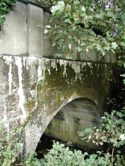 Crettyard BridgeBridge · 2.5 mi
Explorer Tom Crettyard Bridge in Cloneen claims a famous actor used it as a secret rendezvous spot. He probably got stuck under the arch and had to be rescued by locals. A handy spot to stretch your legs out.
 Kilgorey Old BurialVisitor information · 2.6 mi
 Grave YardGraveyard · 2.9 mi
Explorer Tom Graveyard in Kilgory is suspicious of the postman because he keeps dropping letters on dead heads. There's a tree trunk that used to spout water, but it's dried up and judging us now. Bring the dog, it'll have opinions.
 St. Longorys WellHoly well · 2.9 mi
 Killeshin ChurchVisitor information · 3.6 mi
 Killeshin MoatCastle, motte · 3.7 mi
Explorer Tom Killeshin Moat sits on a ridge covered in thorns, making it the world’s most prickly pillow. Its first owner likely fled because the briars got personal. Go on a wet day, it suits the mood.
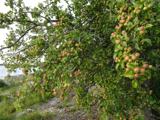 European Crab Apple4.1 mi
Explorer Tom European Crab Apple hears the neighbours arguing through its bark and pretends not to care. It produces tiny, sour fruit that no one wants but everyone respects. Perfect detour when the satnav has a meltdown.
Church (in ruins), GraveyardChurch · 6.0 miExplorer Tom Church, Graveyard in Clogrenan is a late medieval church that has clearly given up on the whole 'looking impressive' thing. It’s sitting in the corner of a graveyard, looking very confused about its own timeline. Ten minutes here and you'll have a yarn for the pub.
 Clogrenan CastleCastle, tower house · 6.2 mi
Explorer Tom Castle in Clarahill refuses to fall down because it thinks gravity is just a suggestion for polite society. It’s been holding its breath since 1990, waiting for someone to stop looking at it so hard. Look for the ghost, then pretend you didn't.
 Estate YardMemorial · 6.3 mi
More mountains and hills in County Laois · All of County Laois

What do you know about this place?Tap to add a comment or ask a question