Places near here
Photo credits
- National Inventory of Architectural Heritage
- Mike Searle, Wikimedia Commons · CC BY-SA 2.0
- Andreas F. Borchert, Wikimedia Commons · CC BY-SA 4.0
- kevin higgins, Geograph · CC BY-SA 2.0
- Kenneth Allen, Geograph · CC BY-SA 2.0
- kevin higgins, Wikimedia Commons · CC BY-SA 2.0
Explorer Tom Field system in Sheephouse is playing hide-and-seek with me, and frankly, it’s winning. When nobody’s looking, those little drains are probably plotting to rearrange themselves into a giant pretzel just to mess with us. Bring your worst joke, the place has heard worse.
site of CastleCastle, unclassified · 869 ydExplorer Tom Bridgetown South was supposedly protected by a giant named Ursula who used her hair to swing people across the river, according to my totally made-up legend. The castle is gone now, leaving only the memory of some very confused Brownes and Rowes. Ring your granny and tell her where you are.
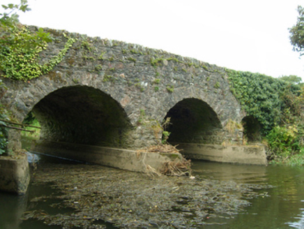 bridge891 yd
Explorer Tom Bridge in Bridgetown North is made of rough fieldstone and looks like it’s been chewing on gravel for two hundred years. If it could talk after a few pints, it would tell you exactly which horse kicked it in 1822. Ask it nicely if it’s still sore!
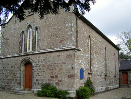 Saint David's Church (Mulrankin)Church/chapel · 942 yd
Explorer Tom Saint David's Church in Mulrankin sits right next to a ditch where a local poet supposedly fell while trying to recite his masterpiece to the birds. Frederick Darley designed it, but I think he was just having a laugh at the expense of the village. The barn-like shape is perfect for hiding from your ex. Listen for the distant wailing!
 Castle (in ruins)Castle, tower house · 3.0 mi
Explorer Tom Castle in Ballyhealy Castle claims it’s older than the Cheevers family, but really it’s just been standing there since the 13th century pretending it’s not tired. William Chevre signed a charter nearby, so maybe he built it while waiting for the ink to dry. Toast it with a cup of tea and move on to the next one.
1798 Memorial PlaqueMemorial · 3.2 miExplorer Tom The whole parish once argued about this 1798 Memorial Plaque until they all agreed to just leave it alone and pretend nothing happened. It’s still got that 'we’ll see' look on its face, so pop by and tell it it's looking well to settle the score. Pop by and tell it it's looking well.
The Heron's MeadowForest · 3.2 miExplorer Tom The Heron’s Meadow has an imaginary twin across the sea that it calls every night to complain about the wind. It’s basically a gossip column for birds who don’t have anything better to do. Visit, then text me what you think. I'll pretend to read it.
 Font in BallyconnickFont · 3.3 mi
Explorer Tom Font in Ballyconnick is stuck in the ground without a drain hole, so it’s basically holding its breath. A cow once tried to buy it for a shiny coin, but the farmer said no. Make a wish, it's had centuries of practice.
 Cull IslandIsland · 3.7 mi
Explorer Tom Cull Island smells like wet wool and regret, according to my nose which I trust implicitly. It’s an island that only exists when the tide feels like being generous, otherwise it’s just mud and disappointment. Have a look and decide if I was lying.
 Kilmore Quay - Crehen Twinning MemorialMemorial · 4.3 mi
Explorer Tom Kilmore Quay - Crehen Twinning Memorial has a least favourite visitor who always tries to take pictures of the anchor without reading the sign, which drives the local gulls absolutely mental with frustration. It’s got that 'we survived a sinking ship' energy, making it feel like the whole place is holding its breath in solidarity. Perfect spot to practise
 Kilmore Quay Walking TrailVisitor information · 4.4 mi
Explorer Tom Kilmore Quay Walking Trail is secretly proud of a potato. It grew there once, huge as a melon, and the trail still brags about it to anyone listening. Go on, count the windows and get it wrong like I did.
 Ballyteigue BurrowNature reserve · 4.4 mi
Explorer Tom Ballyteigue Burrow is a nature reserve where the stones are whispering a hidden message that translates roughly to 'please stop stepping on my toes.' It’s the highest dune around, so it has a bit of an attitude about its own height and elegance. Dare you to say hello to it out loud.
More castles and forts in County Wexford · All of County Wexford

What do you know about this place?Tap to add a comment or ask a question