
Places near here
Photo credits
- National Inventory of Architectural Heritage
- Oliver Dixon, Geograph · CC BY-SA 2.0
- N Chadwick, Geograph · CC BY-SA 2.0
- Kieran Campbell, Wikimedia Commons · CC BY-SA 2.0
- Kmcnamee, Wikimedia Commons · CC BY-SA 4.0
- Djm-leighpark, Wikimedia Commons · CC BY-SA 4.0
- Michael Murtagh, Geograph · CC BY-SA 2.0
- Sawyer777, Wikimedia Commons · CC BY-SA 4.0
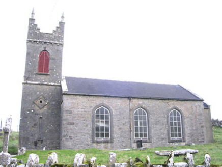 Saint Thomas's Church (Kilmactranny)Church/chapel · 1.0 mi
Explorer Tom Saint Thomas's Church in Carrickard has very strong opinions about modern buildings, mostly that they look like…
 Loughbrick BayBay · 1.5 mi
Explorer Tom Loughbrick Bay in County Sligo would tell you after a few pints that it actually swallowed a boat once but gave it back…
 Barroe NorthMountain / peak · 1.7 mi
Explorer Tom Barroe North thinks it’s cooler than its famous neighbour, but honestly, who are we to judge? It’s got that mysterious…
 Ballindoon Castle (in Ruins)Castle, unclassified · 2.0 mi
Explorer Tom Ballindoon Castle sits on a steep slope where the ground drops eight metres straight into Lough Arrow. The shortcut…
 Giants GravePortal tomb · 2.1 mi
Explorer Tom Giants Grave in Carrickglass is the site of a ridiculous smuggling story involving cheese and a very large roofstone.…
 Geevagh GAAGAA ground · 2.4 miKilronan Park, St. Ronan's GAAGAA ground · 2.9 mi
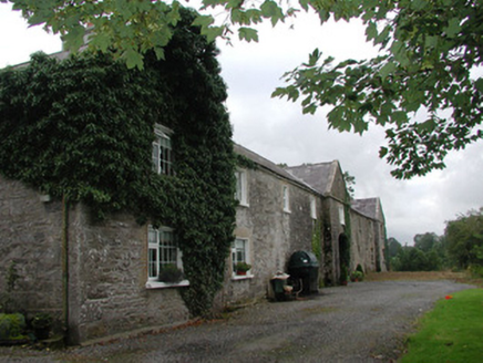 Ardagh HouseFarmyard complex · 5.7 mi
Explorer Tom Ardagh House in Bellanascarva has converted farm buildings that now hide a message about survival in their symmetrical…
 ToberanaltHoly well · 14 mi
Explorer Tom Toberanalt holy well has a legend about a hidden tunnel that goes straight to the local pub, but nobody believes me.…
 CrockaunsMountain / peak · 17 mi
Explorer Tom Crockauns bragged about surviving a storm so violent it rearranged its own topography and sent the local cows into a…
 Queen Medb: RathcroghanLegend location · 19 mi
Explorer Tom Queen Medb: Rathcroghan is where the Táin starts turning a quarrel about a bull into an epic. Medb had a royal seat…
 Glencar IslandIslet · 19 mi
Explorer Tom Glencar Island in County Leitrim would complain to the council about the noise levels from the swans, claiming they’re…
More archaeology and monuments in County Sligo · All of County Sligo

What do you know about this place?Tap to add a comment or ask a question