
Places near here
Photo credits
- National Inventory of Architectural Heritage
- Jonathan Wilkins, Wikimedia Commons · CC BY-SA 2.0
- Kenneth Allen, Geograph · CC BY-SA 2.0
- Kenneth Allen, Wikimedia Commons · CC BY-SA 2.0
- Highland Radio (publisher); individual photographer not stated, highlandradio.com
- Dean Molyneaux, Geograph · CC BY-SA 2.0
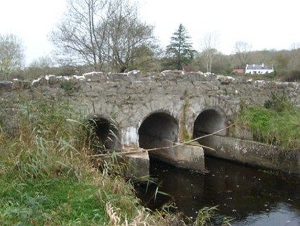 Tullymore BridgeBridge · 692 yd
Explorer Tom Tullymore Bridge puts a gentle hump in the road above the Two Mile Water. Its three arches date from around 1800, while…
 Sheebarran RingfortFairy fort / earthen ringfort · 1323 yd
Explorer Tom Sheebarran Ringfort is a massive circular space with a ditch so wide it could swallow a small car. It sits on the crest…
 bridge1.6 mi
Explorer Tom Bridge in Tonregee has one arch edged in raised render. The narrow gauge trains that passed below this road bridge are…
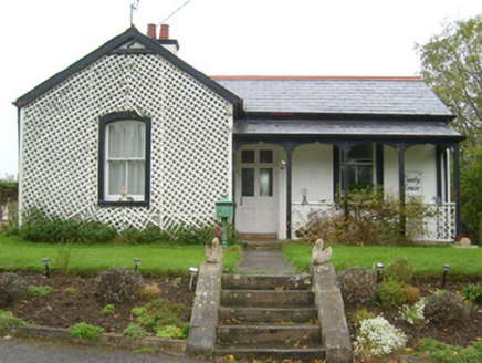 Danby HouseGate lodge · 1.6 mi
Explorer Tom Danby House has a former gate lodge nearby, built around 1870, with an open veranda and timber lattice. The little…
 Shannon's CornerRestaurant · 1.6 mi
Explorer Tom Shannon's Corner restaurant in Donegal would bring a very unremarkable cake to a party because it’s terrified of being…
 McGinley's BarPub · 1.6 mi
Explorer Tom McGinley’s Bar is on Bishop Street, so maybe bring your prayers just in case something weird happens over there. Order…
 Max BarPub · 1.7 mi
Explorer Tom Max Bar is also on Market Street, right next door to other pubs, suggesting a fierce rivalry over who has the best…
 Dicey Reilly’sPub · 1.7 mi
Explorer Tom Dicey Reilly’s is on Market Street, so expect a crowd that knows exactly which side of the argument they're winning.…
 Sean Óg’sPub · 1.7 mi
Explorer Tom Sean Óg’s is on Market Street, and Sean Óg means young Sean, so maybe the owner is younger than his name suggests. Ask…
 Dungravenen Promontory FortPromontory fort, coastal · 1.9 mi
Explorer Tom Dungravenen Promontory Fort is a spectacular coastal spot where you can crawl through rock-cut chambers under the soil.…
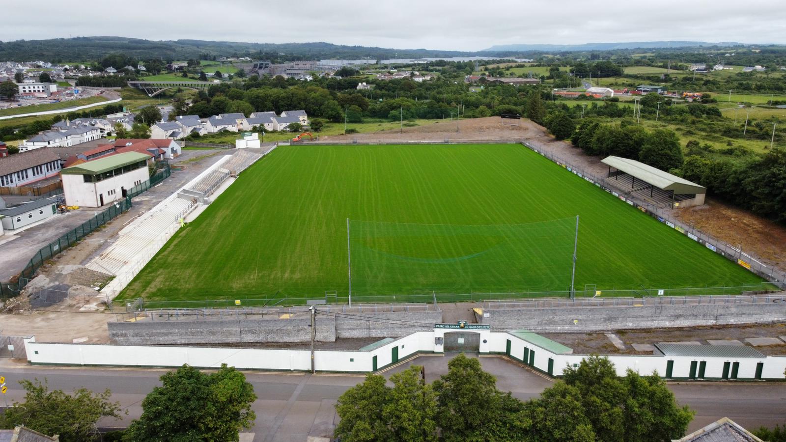 Father Tierney ParkGAA ground · 2.0 mi
 RossnowlaghOfficial bathing water · 2.4 mi
Explorer Tom Rossnowlagh seems to have decided that four kilometres of sand is the minimum space a person needs to think properly.…
More archaeology and monuments in County Donegal · All of County Donegal

What do you know about this place?Tap to add a comment or ask a question