
What is recorded here
Places near here
Picture notes
- Computer-made picture. It does not show this walking route.
- Computer-made picture. It does not show this holy well.
- Computer-made picture. It does not show this mountain top.
- Computer-made picture. It does not show this monument.
- National Inventory of Architectural Heritage
- William Frederick Wakeman (1822-1900), Wikimedia Commons · Public domain
 Holy Well TrailWalking route · 1225 ydComputer-made picture
 Holy well in SlievedooHoly Well · 1.0 miComputer-made picture
 Bannadoo TrailWalking route · 1.1 miComputer-made picture
 Carrickaduff HillMountain / peak · 2.3 miComputer-made picture
Explorer Tom Carrickaduff Hill in County Donegal is full of secrets, or at least that's what the local legend says. It's probably just a hill, but make it sound fancy. Spot the oldest stone and give it a name.
 Island, possibly crannog in SlievedooIsland, possibly crannog · 2.6 miComputer-made picture
 Cross HillMountain / peak · 3.5 miComputer-made picture
Explorer Tom Cross Hill is a mountain peak in County Donegal that seems to have skipped the 'how do I get up here' chapter entirely. With access unknown, it’s basically a giant shrug waiting for someone to guess the right way up while pretending they know exactly where they are going.
Lough Derg ForestForest · 3.7 miExplorer Tom Lough Derg Forest sits near a famous pilgrimage spot, so I bet there are more prayers being said under those trees than actual birdsong. The name sounds serious, but it's probably just a place where people go to clear their heads and lose their way. See if any pilgrims are hiding in there!
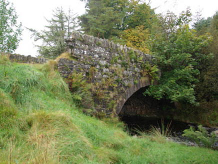 bridge3.8 mi
Explorer Tom Bridge in Croaghonagh is a single-arched structure built from local rubble stone with high-quality dressed stone voussoirs that show off real craftsmanship. It’s got rustic appeal in the upland landscape south-west of Ballybofey. Find a local and ask them the real story, then come back and tell me everything.
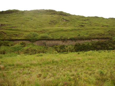 viaduct, bridge, embankment4.7 mi
Explorer Tom Viaduct, Bridge, Embankment in Keadew Upper marks the old railway route into the Barnesmore Gap. The line opened towards Donegal Town in 1889 and later changed gauge; that plain stone bridge kept its place after trains stopped in 1960.
 Saints IslandIsland · 4.7 mi
Explorer Tom Saints Island sounds like the place to land for the Lough Derg pilgrimage, but that is Station Island next door. This island held the early monastery; Lough Derg calls it overgrown and inaccessible. Even my map needs the two islands kept straight.
Bulls IslandIslet · 4.8 miExplorer Tom Bulls Island sounds like a place where only aggressive livestock survive the winter in County Donegal. Go with someone who loves old stuff and watch them melt, or at least pretend they're melting for the camera.
More walking routes in County Tyrone · All of County Tyrone

What do you know about this place?Tap to add a comment or ask a question