What is recorded here
From the National Monuments Service (Archaeological Survey of Ireland) record CO135-009002
Places near here
Picture notes
- Computer-made picture. It does not show this monument.
- National Inventory of Architectural Heritage
- Marathon, Wikimedia Commons · CC BY-SA 2.0
- Kenneth Allen, Geograph · CC BY-SA 2.0
- Computer-made picture. It does not show this garden.
- Hywel Williams, Wikimedia Commons · CC BY-SA 2.0
- Wsiegmund, Wikimedia Commons · CC BY 2.5
- Draceane, Wikimedia Commons · CC BY-SA 4.0
- Podstawko, Wikimedia Commons · CC BY-SA 4.0
- Caitlin Ferguson-Mir, Wikimedia Commons · CC BY-SA 2.0
 Fairy fort / earthen ringfort in KilgarriffFairy fort / earthen ringfort · 525 ydComputer-made picture
Explorer Tom Fairy fort / earthen ringfort in Kilgarriff is in tillage with stone-faced parts. It’s got a 2.8-metre entrance to the southwest. The bank is only one metre high, so the fairies probably just walk over it anyway.
 Fulacht fia in CasheliskyFulacht fia · 785 ydComputer-made picture
Explorer Tom Fulacht fia in Cashelisky got paved over for a road, which is basically ancient history's way of saying 'traffic wins.' It's now just a smudge on the bank where someone once boiled a deer. Leave nothing but footprints and a bad pun.
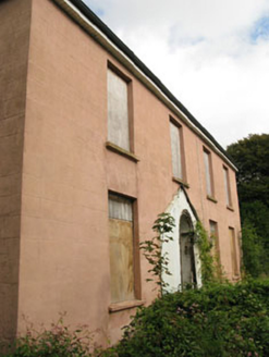 BeechgroveHouse · 1.1 mi
Explorer Tom Beechgrove in Tawnies Lower has sash windows that whisper secrets to the slate roof. It’s simple but keeps all its historic features handy. Twist this tale: grab a photo before the outbuildings get jealous!
 teacher's house1.5 mi
Explorer Tom Teacher's house in Tawnies Upper was built for school masters back in 1890, sitting quietly on Western Road with its gablet and sash windows. It’s a modest reminder of the housing provisions made for educators, probably still grading papers in its dreams.
 Michael Collins House MuseumMuseum · 1.6 mi
 Clonakilty Tourist OfficeVisitor information · 1.8 mi
 Clonakilty Garden of RemembranceGarden · 2.1 miComputer-made picture
 Michael Collins MemorialMemorial · 2.6 mi
 Sitka Spruce4.7 mi
Explorer Tom Sitka Spruce in County Cork thinks it's a spy because it stands so straight. Find the date carved somewhere and feel clever, even if it's just a bark bite.
 Chilean myrtle4.8 mi
Explorer Tom Chilean myrtle in County Cork is having a midlife crisis because it's from South America but stuck in Ireland. It told me it misses the humidity and judges your accent. Go back in winter, it'll be sulking harder.
 Castlefreke CastleRuins · 4.9 mi
Explorer Tom Castlefreke Castle in County Cork is a ruin with a name that sounds like it should be in a fantasy novel. It's definitely adding some drama to the landscape.
 Ownahincha Strand (West)Beach / strand · 5.6 mi
More archaeology and monuments in County Cork · All of County Cork

What do you know about this place?Tap to add a comment or ask a question