
What is recorded here
From OpenStreetMap (© OpenStreetMap contributors) n3761319759
Places near here
Photo credits
- Maker not stated on source page, scotlanditineraryplanning.com
- Maker not stated on source page, www.pinterest.com
- Kenneth Allen, Geograph · CC BY-SA 2.0
- Colin Park, Geograph · Creative Commons Attribution-ShareAlike 2.0
- Patrice78500, Wikimedia Commons · Public domain
- John Martin, Geograph · CC BY-SA 2.0
- Colin Park, Wikimedia Commons · CC BY-SA 2.0
- National Inventory of Architectural Heritage
- Ciaran Mac Murchaidh / Geograph Britain and Ireland, Wikimedia Commons
- Maker not stated on source page, www.pinterest.ca
- Joseph Mischyshyn, Geograph · CC BY-SA 2.0
- Rod Grealish, Geograph · CC BY-SA 2.0
 Standing stone in Fána BhuíStanding stone · 282 yd
Explorer Tom Standing stone in Fána Bhuí looks like a giant’s pencil that got sharpened on one end! It tapers to a point at the east…
 Megalithic tomb in Fána BhuíMegalithic tomb · 762 yd
Explorer Tom Megalithic tomb in Fána Bhuí was once known as Dermot and Grania's Bed, which sounds like a very romantic spot for a…
 McGeady's BarPub · 1.8 mi
Explorer Tom McGeady’s Bar is sitting there looking suspiciously quiet in County Donegal, waiting for someone to ask if they’ve had…
 Catholic Church of the Sacred HeartChurch/chapel · 1.8 mi
Explorer Tom Catholic Church of the Sacred Heart stands between Errigal Mountain and Lough Nacung, with a round tower and a…
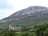 Errigal / An EaragailMountain / peak · 1.8 mi
Explorer Tom Errigal looks as though Donegal sharpened a mountain into a bright grey point just to make everyone look up. On a clear…
 Errigal Youth HostelHostel · 1.9 mi
Explorer Tom Errigal Youth Hostel in County Donegal is where dreams go to get squished under mattresses. It's cozy if you define…
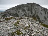 MackoghtMountain / peak · 2.0 mi
Explorer Tom Mackoght stands beside Errigal in County Donegal like the smaller sibling who knows exactly how photogenic the family…
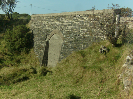 bridge3.9 mi
Explorer Tom Bridge in Tullaghobegly Scotch was built around 1903 to carry a road over the railway. The survey found the old arch…
 Siúlóid an Chlocháin BhigOfficial walking route · 4.9 mi
Explorer Tom Siúlóid an Chlocháin Bhig has a name that may test your tongue and a route that rewards your feet. This Crolly loop…
 Tullabegley GraveyardGraveyard · 5.0 mi
Explorer Tom Tullabegley Graveyard in County Donegal holds a curse that only bites you if you don’t wave first when you pass by. I…
 The Bridge of TearsMemorial · 5.4 mi
Explorer Tom The Bridge of Tears carried more than traffic through Muckish Gap. Families once came this far with people leaving for…
 Astelleen Burn WaterfallWaterfall · 5.7 mi
Explorer Tom Astelleen Burn Waterfall is the reward for carrying on beyond Glenveagh Castle when everyone else has decided the…
More mountains and hills in County Donegal · All of County Donegal

What do you know about this place?Tap to add a comment or ask a question