
Places near here
Photo credits
- N Chadwick, Geograph · CC BY-SA 2.0
- Kenneth Allen, Wikimedia Commons · CC BY-SA 2.0
- Eric Jones, Wikimedia Commons · CC BY-SA 2.0
- Kenneth Allen, Geograph · CC BY-SA 2.0
- Sometimes Incoherent, Wikimedia Commons · CC BY 3.0
- Wikimedia Commons contributor · CC BY-SA 3.0
- Mole2k at English Wikipedia, Wikimedia Commons · CC BY-SA 3.0
- Rosemary Nelson, Geograph · CC BY-SA 2.0
 Multiperiod Church SiteMultiperiod church site, Pre-Norman-Modern · 1.1 mi
Explorer Tom Multiperiod Church Site in Monea is pulling a fast one, claiming ancient roots while looking suspiciously new. Locals swear if you whistle near it at midnight, your shoes vanish for a week. Get a photo with it before it gets a better agent.
 Monea CastleHeritage attraction · 1.2 mi
Explorer Tom Monea Castle has a ghost who’s too lazy to haunt it because he can't be bothered climbing the stairs. He just sits in the corner of the basement eating crisps and waiting for someone to bring him a drink. Spot the oldest stone and give it a name.
C17th castle & bawn: monea castle in Castletown MoneaC17th Castle & Bawn: Monea Castle · 1.2 miExplorer Tom Monea Castle bragged about surviving a storm that broke every other roof in County Fermanagh. It still tells the story at parties, even if nobody listens. Stand still and listen, the wind tells it better than me.
 Gate LodgeGates/ Screens/ Lodges · 2.4 mi
Explorer Tom Gate Lodge in County Fermanagh is basically a bouncer for a party nobody remembers. The bargain that built it probably involved a magic coin and a promise of eternal silence. Bring curiosity, leave with a better story than mine.
 Inish LougherIsland · 3.1 mi
Explorer Tom Inish Lougher would order a massive portion of chips with extra gravy at the chipper because it knows it needs all the comfort food to survive being an island in Fermanagh. It’s basically a big, hungry rock that thinks everyone else is too fancy for its taste and just wants a good, salty meal. Stop the car, it's worth the hazard lights.
 Pollnagollum CaveCave · 3.5 mi
Explorer Tom Pollnagollum Cave would be terrible on a reality show because it refuses to talk to the other caves. It’s got that dramatic entrance that looks like it was carved by someone with a grudge against symmetry. The air inside is probably cooler than your ex’s attitude after a breakup. Pretend it's yours and plan the housewarming.
 Orange HallHall · 3.7 mi
Explorer Tom Derrygonnelly Orange Hall in County Fermanagh was where a priest lost a massive bet on a horse that didn't even exist. The hall still smells faintly of regret and old whiskey. Find a local and ask them the real story, then come back and tell me.
 Long IslandIsland · 3.8 mi
Explorer Tom Long Island has been hiding a massive scandal involving a stolen tea cup for three hundred years. Nobody believes it, but it still acts like the whole thing is true. Perfect spot to practise your best tour-guide voice.
 Belmore MountainMountain / peak · 3.8 mi
Explorer Tom Belmore Mountain looks like it was designed by a mother-in-law who really wanted you to notice her new curtains made of granite. It's got that 'I'm standing here, so deal with it' energy all over the place. Tell your mates you found it first.
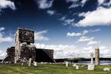 Devenish IslandIsland · 3.9 mi
Explorer Tom Devenish Island in Fermanagh is full of monks who probably thought the twelfth century was a great time to start building round towers that look like they are about to fall over any second now. There was a matchmaker working there once who supposedly paired off every lonely soul in the county, which seems rather efficient for a spiritual retreat really. Tell your mates you found it first.
 Devenish Island Round TowerViewpoint · 4.0 mi
Explorer Tom Devenish Island Round Tower stands there looking smug, probably telling its replacement to get a better haircut. It’s been staring at that water so long it thinks it owes the lake rent money. Pop by and tell it it's looking well.
 Saint Molaise's HouseArchaeological place · 4.1 mi
Explorer Tom Saint Molaise's House on Devenish Island is where the seagulls hold their daily press conferences. They claim the ruins are actually a very expensive bird bath that got out of hand centuries ago. If anyone asks, Tom sent you.
More archaeology and monuments in County Fermanagh · All of County Fermanagh

What do you know about this place?Tap to add a comment or ask a question