
What is recorded here
Gate Lodge in Ballyhose is a whole house at the entrance to an estate. That's wealth for you: most of us answer our own door; these people built another home so somebody else could find out whether the visit was worth getting up for.
Current recorded use: Gates/ Screens/ Lodges.
From the Northern Ireland Historic Buildings Record record HB12/11/089
The official record and map point do not grant access. Many historic buildings are privately owned; view them only from public ground unless the owner allows entry.
Places near here
 Long IslandIsland · 1.4 mi
 Inish LougherIsland · 1.4 mi
 Monea CastleHeritage attraction · 1.6 mi
 Multiperiod Church SiteMultiperiod church site, Pre-Norman-Modern · 2.1 mi
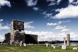 Devenish IslandIsland · 2.5 mi
 St. Michael's ChurchChurch · 2.6 mi
 Devenish Island Round TowerViewpoint · 2.7 mi
 Saint Molaise's HouseArchaeological place · 2.7 mi
 Teampull MórRuins · 2.7 mi
 Portora CastleCastle · 3.4 mi
 Enniskillen castle in EnniskillenEnniskillen Castle · 4.3 mi
 Boer War MemorialMemorial · 4.3 mi
Pictures: Kenneth Allen, Geograph · CC BY-SA 2.0; Kenneth Allen, Wikimedia Commons · CC BY-SA 2.0; N Chadwick, Geograph · CC BY-SA 2.0; Mole2k at English Wikipedia, Wikimedia Commons · CC BY-SA 3.0; Eric Jones, Wikimedia Commons · CC BY-SA 2.0; Rosemary Nelson, Geograph · CC BY-SA 2.0; HENRY CLARK, Wikimedia Commons · CC BY-SA 2.0
More historic places in County Fermanagh · All of County Fermanagh
What do you know about this place?