
What is recorded here
From the Northern Ireland Sites and Monuments Record record FER153:003
Places near here
Photo credits
- National Inventory of Architectural Heritage
- Kenneth Allen, Wikimedia Commons · CC BY-SA 2.0
- Kenneth Allen, Geograph · CC BY-SA 2.0
- Derek Henry, Geograph · CC BY-SA 2.0
- Jo and Steve Turner, Geograph · CC BY-SA 2.0
- IJA, Wikimedia Commons · CC BY-SA 4.0
- Mcg sean, Wikimedia Commons · CC BY-SA 3.0
- Jon Sullivan, Wikimedia Commons · Public domain
- Oliver Dixon, Geograph · CC BY-SA 2.0
- Kenneth Allen, Geograph · Creative Commons Attribution-ShareAlike 2.0
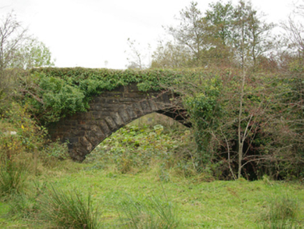 Pettigoe Railway BridgeBridge · 1.7 mi
Explorer Tom Pettigoe Railway Bridge in Drumharriff is straddling the Termon River like a giant stone lego block from 1865. The line closed in '57, so it's basically just posing now. Wave hello to the Victorian masonry!
 The Station HouseRailway station · 1.8 mi
Explorer Tom The Station House in Drumharriff is a grand affair with snecked stone masonry and quality tooling. The railway company really went all out here, even if the trains stopped running in 1957. Imagine the gossip on those platforms!
 Britton’s BarPub · 1.9 mi
Explorer Tom Britton’s Bar in Pettigo dates from eighteen sixty and smells like old wood and last calls. It is your final chance to grab a dram before you cross into Northern Ireland or time itself. A good place to forget your phone for ten minutes.
 Pettigo InnPub · 2.0 mi
Explorer Tom Pettigo Inn might be hiding a secret stash of pints behind the bar for the regulars. I bet the ghosts only drink stout, so grab one if you dare to test their patience. Visit, then text me what you think. I'll pretend to read it.
 Drummoney WaterfallWaterfall · 2.2 mi
 Cruninish IslandIsland · 2.4 mi
 Crevenish CastleHeritage attraction · 2.5 mi
 Castle McGrathCastle, tower house · 2.6 mi
Explorer Tom Castle McGrath was called a 'prittie castle' in a 1611 account, but I would give its five-storey tower-house and gun-looped bawn a sterner name. Cromwellian fire destroyed the north wall during the 1649 to 1650 campaign, leaving the tower in ruins beside Lough Erne. 'Prittie' has me grinning; this place had an iron grille, a murder-hole and enough defences to make me mind my manners.
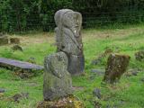 Boa IslandIsland · 2.7 mi
 Standing stone in ClareviewStanding Stone · 3.3 mi
Explorer Tom A metre-high standing stone in Clareview is writing a dating profile where it claims to be 'emotionally unavailable and prehistoric.' It’s basically the incel of the Neolithic era, honestly. Pick a stone, any stone, and invent its biography.
 Sallow IslandIslet · 3.4 mi
 Stone Figures in Caldragh Graveyard: Boa Island in DreenanStone Figures in Caldragh Graveyard: Boa Island · 4.0 mi
Explorer Tom Stone Figures in Caldragh Graveyard: Boa Island has a face looking from opposite sides, which is very confusing for geology. Best seen with a hangover and a sausage roll.
More archaeology and monuments in County Fermanagh · All of County Fermanagh

What do you know about this place?Tap to add a comment or ask a question