
Places near here
Photo credits
- Kenneth Allen, Wikimedia Commons · CC BY-SA 2.0
- Kenneth Allen, Geograph · Creative Commons Attribution-ShareAlike 2.0
- Kenneth Allen, Geograph · CC BY-SA 2.0
- Mole2k at English Wikipedia, Wikimedia Commons · CC BY-SA 3.0
- Rosemary Nelson, Geograph · CC BY-SA 2.0
 Parish Church Of MagheracrossChurch · 896 yd
Explorer Tom Parish Church Of Magheracross in Ballinamallard has been locked in a furious feud with the rain for at least two centuries now. It’s just standing there getting wetter and more annoyed about it. Tell the kids it's a castle. Close enough.
 Methodist ChurchChurch · 969 yd
Explorer Tom The Methodist Church in Ballinamallard was built on a bargain so good the devil should have signed the contract himself. It still looks like it’s waiting for its change to come back. Bring a coin for luck and keep it in your pocket.
 Multiperiod church & graveyard in MagheracrossMultiperiod Church & Graveyard · 1.7 mi
Explorer Tom Multiperiod church & graveyard in Magheracross has been around so long it’s seen more fashion disasters than a runway show. I bet they ran out of tea before the foundation dried. Take a breath of that air, it's older than your car.
_,_Irvinestown_-_geograph.org.uk_-_357778.jpg/250px-Necarne_Castle_(Castle_Irvine)_,_Irvinestown_-_geograph.org.uk_-_357778.jpg "Photo: Kenneth Allen, Wikimedia Commons · CC BY-SA 2.0") Necarne CastleRuins · 2.9 mi
Necarne CastleRuins · 2.9 miExplorer Tom Necarne Castle is basically just a pile of rocks that local sheep have used as a designated scratching post for the last two centuries, which they seem quite pleased about. They look at it with such disdain that you feel like *you’re* the one who needs to apologize for existing. Find the wonkiest bit and send it to your group chat.
 C17th house & bawn: necarne castle in Castle Irvine DemesneC17th House & Bawn: Necarne Castle · 2.9 mi
Explorer Tom Necarne Castle has a ghost that’s too lazy to haunt it properly. He mostly just naps in the drafty corners and complains about the damp. Take a breath of that air, it's older than your car.
 Cassidy WoodWood · 3.1 mi
Explorer Tom Cassidy Wood plans to retire by turning into a very fancy compost heap in about fifty years. It’s already looking a bit tired, so who can blame it? Ideal stop for a big stretch and a bigger yawn.
 Standing stone in LisnahannaStanding Stone · 3.1 mi
Explorer Tom Standing stone in Lisnahanna would be the uncle at a wedding who stands in the corner, drinking too much champagne, and making awkward eye contact with everyone but never actually saying a word to anyone. It’s got that vibe of being present but desperately wishing it was anywhere else on Earth right now.
 Two standing stones in LisnahannaTwo Standing Stones · 3.2 mi
Explorer Tom Two standing stones in Lisnahanna are the shortcut that isn’t a shortcut because they’re so close together that you have to squeeze between them like a very clumsy cat trying to fit through a tiny door frame. It’s not efficient at all, but it does make for a great story about your spatial awareness.
 Long IslandIsland · 3.3 mi
Explorer Tom Long Island has been hiding a massive scandal involving a stolen tea cup for three hundred years. Nobody believes it, but it still acts like the whole thing is true. Perfect spot to practise your best tour-guide voice.
 Paris Island BigIsland · 3.6 mi
Explorer Tom Paris Island Big once survived a storm so bad the clouds had to file for divorce, and it still brags about it every time someone passes by. It’s basically a giant stone pillow waiting for you to take a nap on it while pretending you’re in France. A handy spot to stretch your legs and your imagination.
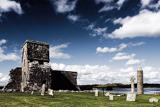 Devenish IslandIsland · 4.2 mi
Explorer Tom Devenish Island in Fermanagh is full of monks who probably thought the twelfth century was a great time to start building round towers that look like they are about to fall over any second now. There was a matchmaker working there once who supposedly paired off every lonely soul in the county, which seems rather efficient for a spiritual retreat really. Tell your mates you found it first.
 Devenish Island Round TowerViewpoint · 4.3 mi
Explorer Tom Devenish Island Round Tower stands there looking smug, probably telling its replacement to get a better haircut. It’s been staring at that water so long it thinks it owes the lake rent money. Pop by and tell it it's looking well.
More archaeology and monuments in County Fermanagh · All of County Fermanagh

What do you know about this place?Tap to add a comment or ask a question