
What is recorded here
Multiperiod church & graveyard in Magheracross is a multiperiod church & graveyard in County Fermanagh, Ireland.
From the Northern Ireland Sites and Monuments Record record FER193:005
The monument record does not grant public access. Check the route and ask the landowner before entering private land.
- What survives
- Recorded monument
Places near here
 Methodist ChurchChurch · 1.3 mi
 Parish Church Of MagheracrossChurch · 1.4 mi
 Standing stone in LisnahannaStanding Stone · 1.6 mi
 Two standing stones in LisnahannaTwo Standing Stones · 1.7 mi
_,_Irvinestown_-_geograph.org.uk_-_357778.jpg/250px-Necarne_Castle_(Castle_Irvine)_,_Irvinestown_-_geograph.org.uk_-_357778.jpg "Photo: Kenneth Allen, Wikimedia Commons · CC BY-SA 2.0") Necarne CastleRuins · 3.7 mi
Necarne CastleRuins · 3.7 mi C17th house & bawn: necarne castle in Castle Irvine DemesneC17th House & Bawn: Necarne Castle · 3.7 mi
 Brougher MountainMountain / peak · 4.1 mi
 Cassidy WoodWood · 4.2 mi
 Long IslandIsland · 5.1 mi
 Topped MountainMountain / peak · 5.3 mi
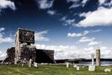 Devenish IslandIsland · 5.5 mi
 Devenish Island Round TowerViewpoint · 5.6 mi
Pictures: Kenneth Allen, Wikimedia Commons · CC BY-SA 2.0; Kenneth Allen, Geograph · CC BY-SA 2.0; Mole2k at English Wikipedia, Wikimedia Commons · CC BY-SA 3.0; Rosemary Nelson, Geograph · CC BY-SA 2.0
More memorials and graveyards in County Fermanagh · All of County Fermanagh
What do you know about this place?