
What is recorded here
From the Northern Ireland Sites and Monuments Record record ARM016:002
Places near here
Picture notes
- Computer-made picture. It does not show this monument.
- Computer-made picture. It does not show this playground.
- Chris Sampson, Wikimedia Commons · CC BY 2.0
- Eric Jones, Wikimedia Commons · CC BY-SA 2.0
- Jon Sullivan, Wikimedia Commons · Public domain
- James O'Neill, Wikimedia Commons · CC BY-SA 4.0
- Kenneth Allen, Geograph · CC BY-SA 2.0
- Eric Jones, Geograph · CC BY-SA 2.0
- Sean Davis, Geograph · CC BY-SA 2.0
 RathArchaeological place · 715 ydComputer-made picture
Explorer Tom This particular Rath sits quietly, its circular shape a testament to the enduring architectural preferences of early settlers.
 Possible barrow & tree ring in BallyardsPossible barrow & tree ring · 720 ydComputer-made picture
Explorer Tom Ballyards has a possible barrow and tree ring combo. Sounds like a very confused forest meeting. Best seen with a hangover and a sausage roll.
 Milford Play ParkChildren's playground · 1308 ydComputer-made picture
Explorer Tom Milford Play Area feels like it could hold endless secrets for young explorers ready to discover them.
 Children's playground1.6 miComputer-made picture
Explorer Tom This County Armagh playground might have a magic mirror that shows you your future superhero self if you look.
.jpg/250px-D823BGM_101010_CPS_(5072007793).jpg "Photo: Chris Sampson, Wikimedia Commons · CC BY 2.0") Mullacreevie ambushAmbush · 1.6 mi
Mullacreevie ambushAmbush · 1.6 miExplorer Tom Mullacreevie ambush in County Armagh has a least favourite visitor, and it’s definitely that guy who talks too loud in cafes. It’s a spot with great vibes if you ignore the history. Go at sunset and thank me later for the chill.
 Primate's ChapelChurch · 1.7 mi
Explorer Tom The Primate's Chapel is so fancy it probably has its own valet, and I swear the first owner had an escape route made of pure ego. Ideal stop for a big stretch and a bigger yawn.
 Roughan HouseHouse · 1.9 mi
Explorer Tom Roughan House at Callan Bridge was saved by a hero nobody remembers, probably because he fell asleep on the job. Wave at the cows, they're the real locals.
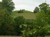 Macha's Curse: Navan FortLegend location · 2.0 mi
Explorer Tom Macha's Curse: Navan Fort tells of a king who made a pregnant goddess race his horses. She won and cursed Ulster's men for his cruelty. I do like a victory, but this king made the very worst choice of opponent. The fort's earthworks are real; the race belongs to legend.
 Battle of ClontibretMajor battlefield · 2.2 mi
Explorer Tom The Battle of Clontibret happened nearby, where Hugh O'Neill ambushed the English. Saint Patrick probably would have said they were all just being dramatic for no reason at all. Pretend you're a lost aristocrat, nobody will check.
 Armagh Rail Disaster Memorial SculptureMemorial · 2.2 mi
Explorer Tom The Armagh Rail Disaster Memorial Sculpture stands as a quiet reminder of a tragic journey that started from Abbey Street long ago.
 Crimean CannonMemorial · 2.2 mi
Explorer Tom That Crimean Cannon on the Mall is a real time capsule. It was captured in 1854 and has been watching Armagh ever since.
 Keady GlenForest · 5.1 mi
Explorer Tom Keady Glen forest runs parallel to the River Clea, leading towards the Old Mill where the water probably hums a catchy tune.
More archaeology and monuments in County Armagh · All of County Armagh

What do you know about this place?Tap to add a comment or ask a question