What is recorded here
Mona part of the name comes from the fact that turf was harvested from this beach at one time.
From OpenStreetMap (© OpenStreetMap contributors) w165620581
Places near here
Photo credits
- Mac McCarron, Geograph · CC BY-SA 2.0
- Martin Southwood, Geograph · CC BY-SA 2.0
- National Inventory of Architectural Heritage
- Mike Searle, Geograph · CC BY-SA 2.0
- Mac McCarron, Geograph · Creative Commons Attribution-ShareAlike 2.0
Stony BeachBeach / strand · 199 yd Drishane IslandIslet · 248 ydMan-made underground passage in Bawnlahan (carbery West (e.d.) By., Castlehaven Par.)Man-made underground passage · 622 ydTralispeanBeach / strand · 1107 ydWild Atlantic Way:Toe HeadVisitor information · 1746 ydWild Atlantic Way:Toe Head BayVisitor information · 1.2 miGiant's GraveArchaeological place · 1.2 miBullock IslandIslet · 1.2 miAn GoibínHeadland · 1.3 miLough Ine HouseHunting/fishing lodge · 1.4 miLiss ArdGate lodge · 1.6 miShour WellHoly well · 1.9 mi
 Drishane IslandIslet · 248 ydMan-made underground passage in Bawnlahan (carbery West (e.d.) By., Castlehaven Par.)Man-made underground passage · 622 ydTralispeanBeach / strand · 1107 ydWild Atlantic Way:Toe HeadVisitor information · 1746 ydWild Atlantic Way:Toe Head BayVisitor information · 1.2 miGiant's GraveArchaeological place · 1.2 mi
 Bullock IslandIslet · 1.2 miAn GoibínHeadland · 1.3 mi
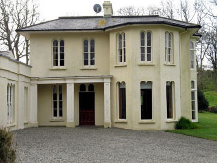 Lough Ine HouseHunting/fishing lodge · 1.4 mi
 Liss ArdGate lodge · 1.6 mi
 Shour WellHoly well · 1.9 mi
More beaches and strands in County Cork · All of County Cork
What do you know about this place?