What is recorded here
Situated on flat pasture with good views in all directions. The medieval settlement at Thurles appears to have been established along a fording point of the River Suir which runs N-S along the E side of the present town. Thurles was established as an Anglo-Norman town (TN041-042----) by Theobald Walter in the late twelfth century around which time the earth and timber motte-castle (TN041-042004-) was constructed (Bradley 1985, 54; Empey 1989, 32, 36). This Anglo-Norman fortification known locally as the 'Moat' was located 70m NW of Liberty Square in the NW quadrant of the medieval town. The earliest reliable reference to a castle in Thurles is in a charter granted by Theobald Walter, who died in 1206 (Curtis 1933, 18). It is recorded that Donal More O'Brien won a military victory here in 1192, presumably his target being the newly established settlement (Smyth 1991, 166-7; Nolan 1989, 12). The borough status of the town is clear from an early fourteenth-century reference (1336) to two knights' fees held as a burgage to the value of £22 17s 2d (Martin 1981, 51; Cal. inq. post mortem, 18) and almost a century later (1432) the reeve and community were summoned to the seneschal's court (Martin 1981, 51; Curtis 1933, 95). It is unclear whether a stone wall was ever constructed around the town of Thurles and no physical remains of a town wall have yet been identified. A stone wall may have been constructed around the town in the second half of the fourteenth century when Thurles received a murage grant dated 1356-7 (Thomas 1992, vol. 2, 192). In this year the Chancery Rolls recorded a royal exemption on 'certain specified customs from articles for sale coming to that town' for a period of 20 years, 'to the town of Thurlys [Thurles] in aid of the paving [of that town] and its enclosure with a stone wall' (Patent Roll 30 Edward III, No. 43). A tentative line of the town wall was suggested by Thomas (1992, 193). The circuit of this proposed wall (area c. 7.5 ha) would only enclose the town of Thurles on the W side of the River Suir, leaving the E side of the town undefended. The wall may have ran parallel to the W bank of the River Suir for a length of c. 250m and then ran parallel to the main street towards 'Black Castle' (TN041-042001-) and the Anglo-Norman motte castle (TN041-042004-) which may have stood close to the NW angle of the town wall. Black Castle, Castle Avenue and Westgate Street may mark the W boundary of the town wall. However Westgate Street may be a reference to the gate of the bawn wall (TN041-042020-) belonging to Black Castle and not to a town wall entrance gate. A gateway may have been located on the E side of the town beside Barry's Bridge (TN041-042006-) and castle (TN041-042002-) where the modern road crosses the River Suir. The Ordnance Survey Letters of 1840 describe a destroyed W gate as geata na gcoileach, they also mention a round building known as Crow's tower which stands at the town to the right of the road to Cashel (O'Flanagan 1930, vol. 2, 78). This tower may have been a mural tower associated with the town walls of Thurles (Carey and Farrelly 1994, 85-100). There is no depiction of a town wall on either the Down Survey map of 1655-9 or Rocque's map of 1755 (NLI 16 I 3/9). It is not certain whether the town defences were of stone (Bradley 1985, 53) but there were gates at E, N and W that gave access to the town. Only the springing arch of the E gate survives protruding from Barry's Castle (TN041-042002-) - there is only the placename evidence for the W gate while there is no surviving evidence for a N gate. See attached image of proposed/suggested line of town wall if it had been constructed around the town of Thurles, taken from The Walled Towns of Ireland (Thomas 1992, 192). Vol. 1 - North Tipperary' compiled by Jean Farrelly and Caimin O'Brien (Dublin: Stationery Office, 2002).
Situated on flat pasture with good views in all directions. The medieval settlement at Thurles appears to have been established along a fording point of the River Suir which runs N-S along the E side of the present town. Thurles was established as an Anglo-Norman town (TN041-042----) by Theobald Walter in the late twelfth century around which time the earth and timber motte-castle (TN041-042004-) was constructed…
From the National Monuments Service (Archaeological Survey of Ireland) record TN041-042007
The monument record does not grant public access. Check the route and ask the landowner before entering private land.
- What survives
- Recorded monument
Places near here
Photo credits
- National Inventory of Architectural Heritage
- Seaniepc007, Wikimedia Commons · CC BY-SA 4.0
- Lár na Páirce Museum, Wikimedia Commons · CC BY 2.0
- Mike Searle, Geograph · CC BY-SA 2.0
- Mike Searle, Wikimedia Commons · CC BY-SA 2.0
- Willow, Wikimedia Commons · CC BY 2.5
- Steven Brown, Geograph · Creative Commons Attribution-ShareAlike 2.0
- Paddy Ryan, Wikimedia Commons · CC BY-SA 4.0
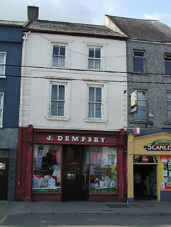 J. DempseyHouse · 40 yd
 1798 MonumentMonument · 43 yd
 Archbishop Croke MonumentMonument · 45 yd
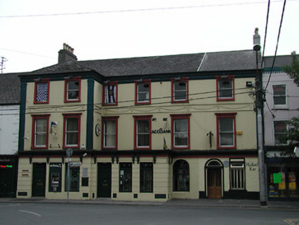 hotel65 yd
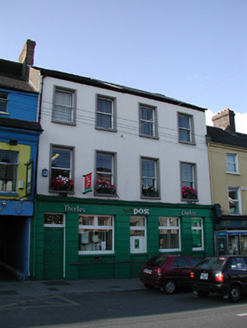 Thurles Post OfficeHouse · 68 yd
 Lár na PáirceMuseum · 103 yd
 Black CastleCastle · 122 yd
 Black CastleCastle, tower house · 125 yd
 European ash857 ydEuropean ash3.0 mi
 Grave YardGraveyard · 9.1 mi
 Devil's Bit MountainMountain / peak · 11 mi
More archaeology and monuments in County Tipperary · All of County Tipperary
What do you know about this place?