What is recorded here
At the N end of a NNE-SSW oriented rocky ridge (L c. 40m), overlooking a generally flat low-lying semi-karstic area and Lough Bunny c. 320m to the S. A modern E-W road is immediately to the N. Indicated as an E-W polygon enclosing ‘Cloondooan Castle (in ruins)’ on the 1842 ed. of the OS 6-inch map, and hachured as a N-S subrectangular area on the 1897 OS 25-inch plan and the 1920 ed. of the OS 6-inch map. This mostly tree-covered and overgrown bawn is not clearly defined. Cloondooan tower house (CL011-007003-) appears to lie at the N edge of the bawn, although Ua Cróinín and Breen (1997) described having seen earthworks immediately to the N, suggesting to them that the modern E-W road cuts through the bawn. The remains of a circular stone tower (diam. c. 4m; H 1.5m) to the SE of the tower house and named ‘Tower’ on the OS maps may demarcate the S extent of the bawn.
At the N end of a NNE-SSW oriented rocky ridge (L c. 40m), overlooking a generally flat low-lying semi-karstic area and Lough Bunny c. 320m to the S. A modern E-W road is immediately to the N. Indicated as an E-W polygon enclosing ‘Cloondooan Castle (in ruins)’ on the 1842 ed. of the OS 6-inch map, and hachured as a N-S subrectangular area on the 1897 OS 25-inch plan and the 1920 ed. of the OS 6-inch map. This…
From the National Monuments Service (Archaeological Survey of Ireland) record CL011-007002
The monument record does not grant public access. Check the route and ask the landowner before entering private land.
- What survives
- Recorded monument
Places near here
Photo credits
- Mike Searle, Wikimedia Commons · CC BY-SA 2.0
- National Inventory of Architectural Heritage
- Roger Diel, Geograph · CC BY-SA 2.0
- Dr Charles Nelson, Wikimedia Commons · CC BY-SA 2.0
- Andreas F. Borchert, Wikimedia Commons · CC BY-SA 4.0
- Humphrey Bolton, Geograph · CC BY-SA 2.0
- John M, Geograph · CC BY-SA 2.0
- The Banner, Wikimedia Commons · CC BY-SA 3.0
- Robert Bone, Geograph · CC BY-SA 2.0
- Paul Woods, Wikimedia Commons · CC BY 2.0
- Dr Charles Nelson, Geograph · CC BY-SA 2.0
_-_geograph.org.uk_-_1541393.jpg/250px-Castles_of_Munster,_Cloondooan,_Clare_(2)_-_geograph.org.uk_-_1541393.jpg "Photo: Mike Searle, Wikimedia Commons · CC BY-SA 2.0") Cloondooan Castle (in ruins)Castle, tower house · 25 yd
Cloondooan Castle (in ruins)Castle, tower house · 25 yd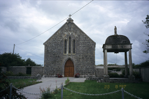 All Saints' Catholic ChurchChurch/chapel · 627 yd
 Kilkeedy Castle (in ruins)Castle, tower house · 1.9 mi
 Cloghans or Round TowerRound tower · 1.9 mi
 Grave YardGraveyard · 1.9 mi
 Kilmacduagh MonasteryHeritage attraction · 2.0 mi
 Church of St. John the Baptist (in ruins)Church · 2.0 mi
 Kilmacduagh Monastic SiteVisitor information · 2.0 mi
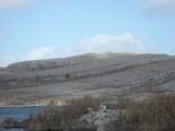 Burren National ParkNature reserve · 3.2 mi
 Slieve RoeMountain / peak · 3.2 mi
 Mullagh MoreMountain / peak · 3.6 mi
 Coole ParkWood · 5.5 mi
More castles and forts in County Clare · All of County Clare
What do you know about this place?