What is recorded here
In pasture, 100m SW of the Augustinian nunnery of Monasternagalliaghduff (LI019-026009-) and 45m W of a megalithic structure (LI019-026011-), with stream immediately to N. On the grounds of the former Old Abbey House which stands 140m to N, orchard and fish ponds (LI019-026006-) in field to N of dovecote. Ringfort…
Read the whole record
In pasture, 100m SW of the Augustinian nunnery of Monasternagalliaghduff (LI019-026009-) and 45m W of a megalithic structure (LI019-026011-), with stream immediately to N. On the grounds of the former Old Abbey House which stands 140m to N, orchard and fish ponds (LI019-026006-) in field to N of dovecote. Ringfort (LI019-028----) 145m to S. Annotated ‘Tower’ on both the 1840 OS 6-inch map and the 1897 OS 25-inch map, where it is depicted as a circular structure (approx. diam. 7m). The dovecote was described by Westropp as ‘the convent pigeon-house. It is an interesting little building, like the base of a round tower. It is circular, and 13 feet 6 inches [4.1m] in internal diameter, shelf to shelf, or 17 feet [5.2m] from wall to wall; the walls 2 feet 8 inches [0.8m] thick and 10 feet [3m] high to the spring of the domed roof, which is formed by corbelling, with a large circular ope and two external cornices. There is a low square door to the west, 3 feet 7 inches [1.1m] high and 2 feet 10 inches [0.86m] wide. The outer face destroyed. Inside were eight rows of stone recesses for the doves; they are 13 inches [0.33m] deep, and about twenty-eight [0.7m] to each ring. The greater number are now destroyed, probably by cattle, which can enter the structure through a large break in the east. It is 18 feet [5.5m] high in all' (Wardell 1904, 64). The dovecote is clearly visible on Google Earth Orthoimage taken 08/04/2015. See attached section of building and Google Earth orthoimages
Compiled by: Martin Fitzpatrick
Date of upload: 13 July 2020
From the National Monuments Service (Archaeological Survey of Ireland) record LI019-026004
Places near here
Photo credits
- A.-K. D., Wikimedia Commons · CC BY-SA 4.0
- National Inventory of Architectural Heritage
- Philip Halling, Geograph · CC BY-SA 2.0
- Mike Searle, Wikimedia Commons · CC BY-SA 2.0
- Roger McLachlan, Wikimedia Commons · CC BY-SA 2.0
- N Chadwick, Geograph · CC BY-SA 2.0
- Wikimedia Commons contributor · Public domain
- Vadim Manuylov, Wikimedia Commons · CC BY-SA 3.0
 MonasternagalliaghduffReligious house, Augustinian nuns · 140 yd
 Burial ground in OldabbeyBurial ground · 171 ydSettlement desertedSettlement deserted, medieval · 346 yd
 Movena HouseCountry house · 563 yd
 Dysert Castle (in ruins)Castle, tower house · 2.2 mi
_-_geograph.org.uk_-_6276707.jpg/250px-Castles_of_Munster,_Dysert,_Limerick_(1)_-_geograph.org.uk_-_6276707.jpg "Photo: Mike Searle, Wikimedia Commons · CC BY-SA 2.0") Dysert CastleCastle · 2.2 mi
Dysert CastleCastle · 2.2 mi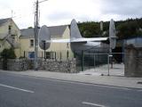 Foynes Flying Boat & Maritime MuseumMuseum · 3.4 mi
 Foynes Island ViewpointViewpoint · 3.6 miGammarel PointHeadland · 3.6 miHolly IslandIslet · 4.0 mi
 Askeaton CastleHeritage attraction · 4.3 mi
 Monterey Cypress4.5 mi
More archaeology and monuments in County Limerick · All of County Limerick
What do you know about this place?Tap to add a comment or ask a question