What is recorded here
Possible medieval settlement earthworks associated with 13th century Augustinian nunnery (LI019-026009-) which are visible on oblique aerial photographs taken 20/07/1968 (CUCAP AVS097-8). A series of linear earthworks forming a series of terraces indicative of strip lynchets running across the fields are visible to the N and NW of the nunnery on Digital Globe orthoimages taken 2011-13. Possible medieval settlement and cultivation earthworks associated with medieval settlement and farming belonging to the Augustinian Nunnery. See attached aerial photographs taken 1968 showing earthworks in field to the N and NW of the Augustinian nunnery.
Possible medieval settlement earthworks associated with 13th century Augustinian nunnery (LI019-026009-) which are visible on oblique aerial photographs taken 20/07/1968 (CUCAP AVS097-8). A series of linear earthworks forming a series of terraces indicative of strip lynchets running across the fields are visible to the N and NW of the nunnery on Digital Globe orthoimages taken 2011-13. Possible medieval…
From the National Monuments Service (Archaeological Survey of Ireland) record LI019-026001
The monument record does not grant public access. Check the route and ask the landowner before entering private land.
- What survives
- Recorded monument
Places near here
Photo credits
- A.-K. D., Wikimedia Commons · CC BY-SA 4.0
- National Inventory of Architectural Heritage
- Philip Halling, Geograph · CC BY-SA 2.0
- Mike Searle, Wikimedia Commons · CC BY-SA 2.0
- Roger McLachlan, Wikimedia Commons · CC BY-SA 2.0
- N Chadwick, Geograph · CC BY-SA 2.0
- Wikimedia Commons contributor · Public domain
- Vadim Manuylov, Wikimedia Commons · CC BY-SA 3.0
Burial ground in OldabbeyBurial ground · 220 yd MonasternagalliaghduffReligious house, Augustinian nuns · 299 ydMovena HouseCountry house · 879 ydEnclosure in CarrowcloghEnclosure · 1367 ydDysert Castle (in ruins)Castle, tower house · 2.0 miDysert CastleCastle · 2.0 miFoynes Flying Boat & Maritime MuseumMuseum · 3.2 miFoynes Island ViewpointViewpoint · 3.4 miGammarel PointHeadland · 3.5 miFoynes IslandIsland · 3.9 miAskeaton CastleHeritage attraction · 4.3 miMonterey Cypress4.3 mi
 MonasternagalliaghduffReligious house, Augustinian nuns · 299 yd
 Movena HouseCountry house · 879 ydEnclosure in CarrowcloghEnclosure · 1367 yd
 Dysert Castle (in ruins)Castle, tower house · 2.0 mi
_-_geograph.org.uk_-_6276707.jpg/250px-Castles_of_Munster,_Dysert,_Limerick_(1)_-_geograph.org.uk_-_6276707.jpg "Photo: Mike Searle, Wikimedia Commons · CC BY-SA 2.0") Dysert CastleCastle · 2.0 mi
Dysert CastleCastle · 2.0 mi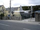 Foynes Flying Boat & Maritime MuseumMuseum · 3.2 mi
 Foynes Island ViewpointViewpoint · 3.4 miGammarel PointHeadland · 3.5 miFoynes IslandIsland · 3.9 mi
 Askeaton CastleHeritage attraction · 4.3 mi
 Monterey Cypress4.3 mi
More archaeology and monuments in County Limerick · All of County Limerick
What do you know about this place?