What is recorded here
Situated at the extreme N end of what was once a triangular island (max. dims c. 700m N-S; c. 220m E-W at S) with the apex at N in Lady’s Island Lough (dims c. 3.5km NNE-SSW; c. 500m-1.5km E-W). A wall (surviving L c. 6m) runs NW from the gatehouse (WX053-014002-) and a wall (surviving L c. 13m; max. H 3.3m) runs SE from the tower house (WX053-014001-), effectively securing the whole island to the S. About 50m NE of the tower house, at the apex of the island is a single tower that has tilted severely to the N and almost collapsed. This feature (ext. dims 5.1m NW-SE; 3.6m NE-SW) has a base-batter on the NE and NW walls, and the remains of the doorway is c. 2m above ground level on the SE side with the tie-stones of a wall beneath it. The ground floor has a garderobe chute on the NW wall that emerges on the outer face of the wall 2m below, and the only other ground floor feature is a cross-loop on the NE wall commanding the causeway (WX053-016----) that connected the island with the mainland, c. 90m distant. The causeway was known as the togher (road), and provided the name Lough Togher to the lake (Hore 1862, 87). The first floor of the tower was supported on corbels in the NE wall, and presumably on the destroyed SW wall. It has two slit windows on the NE wall with a barrel vault rising over them. A photograph from c. 1900 in the Lawrence Collection in NLI (LROY 04780) shows a wall, perhaps not original, running NW from the tower, effectively creating a bawn between the tower and the tower house (WX053-014001-) and gatehouse and their associated walls. Archaeological testing (00E0153) by J. Wren outside the surviving wall at its N end produced no related material (excavations. ie 2000:1063).
Situated at the extreme N end of what was once a triangular island (max. dims c. 700m N-S; c. 220m E-W at S) with the apex at N in Lady’s Island Lough (dims c. 3.5km NNE-SSW; c. 500m-1.5km E-W). A wall (surviving L c. 6m) runs NW from the gatehouse (WX053-014002-) and a wall (surviving L c. 13m; max. H 3.3m) runs SE from the tower house (WX053-014001-), effectively securing the whole island to the S. About 50m NE…
From the National Monuments Service (Archaeological Survey of Ireland) record WX053-015
The monument record does not grant public access. Check the route and ask the landowner before entering private land.
- What survives
- Recorded monument
Places near here
Photo credits
- National Inventory of Architectural Heritage
- Andreas F. Borchert, Wikimedia Commons · CC BY-SA 4.0
- User Ali-oops on en.wikipedia, Wikimedia Commons · GFDL
- Ojsyork, Wikimedia Commons · CC BY 4.0
- DeFacto, Wikimedia Commons · CC BY-SA 4.0
Not indicatedGatehouse · 65 ydLady's IslandVisitor information · 131 yd graveyard/cemetery139 ydChurch in ruinsChurch · 144 ydScargeenIsland · 385 ydInishIsland · 1134 ydSite of CastleCastle, unclassified · 1608 ydCastleHouse, fortified house · 1677 ydShernock Hill/Knocks HillMountain / peak · 1.4 miCarne BeachBeach / strand · 1.5 miLifeboat MemorialMemorial · 1.6 miWindmill (Corn) (Disused)Windmill · 1.8 mi
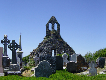 graveyard/cemetery139 yd
 Church in ruinsChurch · 144 ydScargeenIsland · 385 ydInishIsland · 1134 ydSite of CastleCastle, unclassified · 1608 ydCastleHouse, fortified house · 1677 ydShernock Hill/Knocks HillMountain / peak · 1.4 mi
 Carne BeachBeach / strand · 1.5 mi
 Lifeboat MemorialMemorial · 1.6 mi
 Windmill (Corn) (Disused)Windmill · 1.8 mi
More castles and forts in County Wexford · All of County Wexford
What do you know about this place?