What is recorded here
Located on the grounds of the Vincentian college beside Castleknock village. This is a natural hillock known as Windmill Hill. Listed in the Dublin SMR (1988) as an ‘Earthwork Unclassified’ which was based on a reference to ‘a rath’ in the Dublin Penny Journal of 1835 when it stated that Windmill Hill was the remains of a ‘Rath’ (Anon 1835, 237). The hill was determined by the SMR to be the remains of a natural hill and was not included in the Dublin RMP (1998) as the classification had been changed to redundant record. The classification was changed in 2015 from redundant record to burials based results from test excavation carried out in 2007 under licence No. 07E0682Ext. (McLoughlin 2007) which was undertaken around the water tower in advance of the insertion of a new water tank. Four grave-cuts with human skeletal remains were identified east of the extant tower. Development was redesigned to allow for preservation in situ (McLoughlin 2007). Subsequent geophysical survey under Licence no. 07R0233 identified a cross-shaped anomaly (Nicholls 2007) which was interpreted by archaeologist Christine Baker as possibly marking the possible site of the eponymous windmill (DU017-013002-). It is uncertain if there was a medieval windmill at Castleknock and the placename may be a reference to the 18th-century circular ‘Watch Tower’ on the summit of the hill rather than named after the site of a levelled medieval windmill.
Located on the grounds of the Vincentian college beside Castleknock village. This is a natural hillock known as Windmill Hill. Listed in the Dublin SMR (1988) as an ‘Earthwork Unclassified’ which was based on a reference to ‘a rath’ in the Dublin Penny Journal of 1835 when it stated that Windmill Hill was the remains of a ‘Rath’ (Anon 1835, 237). The hill was determined by the SMR to be the remains of a natural…
From the National Monuments Service (Archaeological Survey of Ireland) record DU017-013001
The monument record does not grant public access. Check the route and ask the landowner before entering private land.
- What survives
- Recorded monument
Places near here
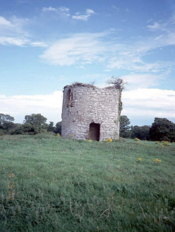 Saint Vincent's CollegeMill (wind) · 14 yd
 Saint Vincent's CollegeCollege · 124 yd
 Saint Vincent's CollegeGate lodge · 140 ydExcavationExcavation, miscellaneous · 191 yd
 Castleknock CastleCastle · 282 yd
 FarmleighHeritage attraction · 565 yd
 The Royal Canal WayWalking route · 728 yd
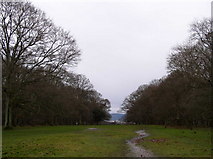 Oldtown WoodWood · 1.2 mi
 Phoenix Park Visitor CentreVisitor information · 1.4 mi
 Ashtown CastleCastle · 1.5 mi
 Knockmaree DolmenArchaeological place · 1.6 mi
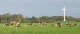 Phoenix ParkPublic park · 1.6 mi
Pictures: National Inventory of Architectural Heritage; Laurel Lodged, Wikimedia Commons · CC BY-SA 4.0; DubhEire, Wikimedia Commons · CC0; JP, Geograph · CC BY-SA 2.0; N Chadwick, Geograph · CC BY-SA 2.0; Frank Winkelmann, Wikimedia Commons · CC BY 3.0; Pier Paolo Lisarelli, Wikimedia Commons · CC BY-SA 4.0; self, Wikimedia Commons · Public domain
More archaeology and monuments in County Dublin · All of County Dublin
What do you know about this place?