What is recorded here
Places near here
Photo credits
- Andreas F. Borchert, Wikimedia Commons · CC BY-SA 4.0
- Arnold Price, Wikimedia Commons · CC BY-SA 2.0
- National Inventory of Architectural Heritage
- Dr Neil Clifton, Wikimedia Commons · CC BY-SA 2.0
- David Dixon, Wikimedia Commons · CC BY-SA 2.0
- David Dixon, Geograph · CC BY-SA 2.0
- Kenneth Allen, Wikimedia Commons · CC BY-SA 2.0
- N Chadwick, Wikimedia Commons · CC BY-SA 2.0
- N Chadwick, Geograph · CC BY-SA 2.0
- Michael Dibb, Wikimedia Commons · CC BY-SA 2.0
- michael clarke stuff, Wikimedia Commons · CC BY-SA 2.0
 InishtrahullIsland · 1.3 mi
Explorer Tom Inishtrahull got a lighthouse in 1812 to help ships using Lough Foyle. I would love to see the lamp from Ireland's most northerly island, but the island is generally inaccessible. This is one for imagining a wave from the mainland, not planning a landing.
 Inishtrahull LighthouseLighthouse · 1.3 mi
Explorer Tom Inishtrahull Lighthouse has a pronounced batter to its base and a diaphone fog signal, standing watchfully at the west end of Inishtrahull Island.
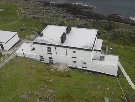 Inishtrahull LighthouseLighthouse keeper's house · 1.3 mi
Explorer Tom Inishtrahull Lighthouse used to relay information by semaphore, which is basically waving arms really fast to say 'boat here!'. I bet the keepers got terrible cramps from all that frantic flapping in the wind.
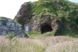 Wee House of Malin CaveCave · 6.4 mi
Explorer Tom Wee House of Malin Cave is measured at only 2.75 metres deep, yet the local saying gives it room for everything that goes in. That is one ambitious little house. The recorded cave sits beside Malin Well and the old church; I would let the story stretch the walls while leaving the real rock alone.
 Eire 80 signSecond World War neutrality sign · 6.9 mi
Explorer Tom EIRE 80 sign was written for eyes in the sky, not for someone standing beside it. The stones told wartime pilots they were over neutral Ireland, and 80 named Malin Head's lookout post. I would take the ground view slowly; this lettering had a much larger audience than most signs.
 Wild Atlantic Way:Malin HeadVisitor information · 7.0 mi
Explorer Tom Malin Head is the most northerly point on the Wild Atlantic Way route, making this visitor information spot a true geographical milestone.
 Malin TowerSignal tower · 7.0 mi
Explorer Tom Behold Malin Tower, a square-plan structure that has served as everything from a signal station to a radio hub! It stands proudly on a rocky outcrop near Malin Head, offering some absolutely unobstructed views of the Atlantic.
 Malin HeadHeritage attraction · 7.0 mi
Explorer Tom Malin Head was known to Ptolemy in the second century as Boreion. That is a remarkably long time for a headland to keep its own name before anyone else noticed it.
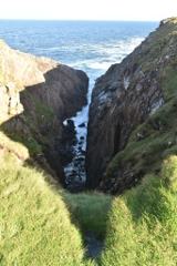 Hell's Hole Cavern, Malin HeadSea cavern and cliff chasm · 7.5 mi
Explorer Tom Hell's Hole Cavern, Malin Head is a long, narrow chasm that sounds like a drum kit being dropped off a cliff. The Atlantic tide rushes in with such a thunderous roar you can hear the water before you see it.
 SkildrenbegIslet · 7.7 mi
Explorer Tom Skildrenbeg has caught my eye in County Donegal. I bet a islet with a name like that could keep me talking all afternoon; I'm already inventing a daft little scene for it, and I'll stop before it turns into history.
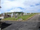 Lag GraveyardGraveyard · 9.4 mi
Explorer Tom Lag Graveyard lies in a natural enclosure of sandhills north of the Trawbreaga Bay channel. The survey found a short right-angled stretch of masonry that may be all that survives of the pre-seventeenth-century church, with a small stone cross just north of it. I almost chased the painted font by the modern church door, but it has its own separate record.
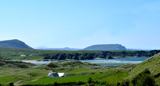 Five Finger StrandBeach / strand · 9.7 mi
Explorer Tom Five Finger Strand near Malin features rocky fingers reaching into the surf, backed by huge dunes that feel wild.
More islands in County Donegal · All of County Donegal
What do you know about this place?