What is recorded here
Situated c. 70m SE of the abbey buildings at Corcomroe (CL003-029002-) just inside the line of the enclosing wall (CL003-029001-) and named ‘Tobersheela’on the 1915 OS 6-inch map. Two small rectangular rock-cut pools (D of water 0.3m; N pool: 1.4m E-W; 0.9m N-S; S pool: 1.15m E-W; 1.6m N-S) separated by an apparently set limestone block (Wth 0.55m; L 1.2m) and feeding a small stream to SW. Fenced off with barbed wire and wooden posts set in concrete and used as a watering hole. 1/1986).
Situated c. 70m SE of the abbey buildings at Corcomroe (CL003-029002-) just inside the line of the enclosing wall (CL003-029001-) and named ‘Tobersheela’on the 1915 OS 6-inch map. Two small rectangular rock-cut pools (D of water 0.3m; N pool: 1.4m E-W; 0.9m N-S; S pool: 1.15m E-W; 1.6m N-S) separated by an apparently set limestone block (Wth 0.55m; L 1.2m) and feeding a small stream to SW. Fenced off with barbed…
From the National Monuments Service (Archaeological Survey of Ireland) record CL003-029004
The monument record does not grant public access. Check the route and ask the landowner before entering private land.
- What survives
- Recorded monument
Places near here
 Corcomroe AbbeyVisitor information · 70 yd
 Corcomroe Abbey Geopark SiteVisitor information · 74 yd
 Corcomroe Abbey (in ruins)Religious house, Cistercian monks · 79 yd
 Battle of Lough RaskaBattle · 946 ydFairy fort / earthen ringfort in Abbey WestFairy fort / earthen ringfort · 952 ydEnclosure in Abbey EastEnclosure · 1301 yd
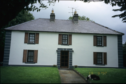 Abbey HouseHouse · 1515 yd
 Saint Patrick's ChurchHeritage attraction · 1597 yd
 Abbey HillMountain / peak · 1694 yd
_-_geograph.org.uk_-_6531658.jpg/250px-Castles_of_Munster,_Muckinishnoe,_Clare_(1)_-_geograph.org.uk_-_6531658.jpg "Photo: Garry Dickinson, Wikimedia Commons · CC BY-SA 2.0") Muckinish Castle (in ruins)Castle, tower house · 1.1 mi
Muckinish Castle (in ruins)Castle, tower house · 1.1 mi_IRL_facing_cairn_view_WNW.jpg/250px-Turlough_Hill(clare)_IRL_facing_cairn_view_WNW.jpg "Photo: Thomas Thiele, Wikimedia Commons · CC BY 3.0") Turlough HillMountain / peak · 1.4 mi
Turlough HillMountain / peak · 1.4 mi The Russell GalleryGallery · 2.3 mi
Pictures: Jonathan Thacker, Geograph · CC BY-SA 2.0; Luisteix, Wikimedia Commons · CC BY-SA 4.0; Andreas F. Borchert, Wikimedia Commons · CC BY-SA 4.0; Dr Charles Nelson, Wikimedia Commons · CC BY-SA 2.0; National Inventory of Architectural Heritage; A McCarron, Wikimedia Commons · CC BY-SA 2.0; Garry Dickinson, Wikimedia Commons · CC BY-SA 2.0; Thomas Thiele, Wikimedia Commons · CC BY 3.0; Mac McCarron, Geograph · CC BY-SA 2.0
More archaeology and monuments in County Clare · All of County Clare
What do you know about this place?