Places near here
Photo credits
- National Inventory of Architectural Heritage
- Sitomon, Wikimedia Commons · CC BY-SA 2.0
- Wanfried-Dublin, Wikimedia Commons · CC BY-SA 4.0
- Kieran Campbell, Geograph · Creative Commons Attribution-ShareAlike 2.0
- Olivier BEZES, Wikimedia Commons · CC BY 2.5
- Garry Dickinson, Geograph · CC BY-SA 2.0
- Tjp finn, Wikimedia Commons · CC BY-SA 4.0
- Nuala Furley, Wikimedia Commons · CC BY-SA 4.0
 milestone/milepost1.2 mi
Explorer Tom Milestone or milepost in Begsreeve is in a rivalry with a more famous stone that never won. It’s just standing there, telling you how far to Collon is. Look serious, nod slowly, and pretend you understand the maths.
Stokestown CastleCastle, unclassified · 1.2 miExplorer Tom Stokestown Castle ended up in the wrong place because someone misread the map back in the day. It’s sitting next to the church, looking confused about whether it’s medieval or just very old-fashioned furniture. Walk past slowly like you're in a film.
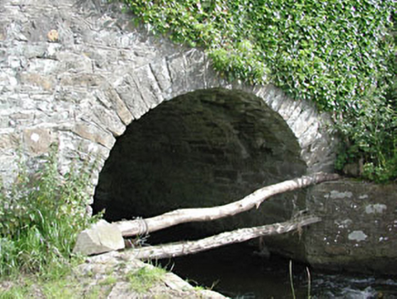 bridge1.3 mi
Explorer Tom Bridge in Benjerstown has strict rules: no jumping, no wading, and absolutely no asking for refunds. It’s just a simple slab pretending to be an engineering marvel. Go on a wet day, it suits the mood perfectly.
Gun HillMountain / peak · 1.7 mi European Yew1.9 mi
Explorer Tom This European Yew is feuding with the next village over something daft, probably about who has the better shade. It’s been going on for years and nobody really cares anymore. Practise your Irish on it, it won't correct you.
 Druids AltarPortal tomb · 1.9 mi
Explorer Tom Druids Altar in Rathkenny hosted a fiddler who played all night without stopping. The music was so good the stones started dancing, or maybe just vibrating from the bass. Give it a pat on the way past, it's had a long life.
 Grave YardGraveyard · 2.0 mi
Explorer Tom Graveyard in Knock wants a New Year’s resolution: to stop being so rectangularly boring and start acting mysterious again. The cross and font are there, but the church is basically a ghost. Go before the tourists find out.
Simpson's MountainMountain / peak · 2.6 mi Lebanon Cedar3.9 mi
Explorer Tom This Lebanon Cedar has an ongoing feud with the rain, complaining that it gets in its hair too much. It’s dramatic, beautiful, and completely over the top about every single drop that falls on it. Go on a wet day, it suits the mood.
 CastleCastle, tower house · 4.2 mi
Explorer Tom Smarmore Castle thinks tourists from Dublin are too loud and don’t know how to hold a pint. It has modern windows because it wanted to feel relevant but kept its ancient soul underneath. A good place to forget your phone for ten minutes.
 Saint Patrick's Fire: Hill of SlaneLegend location · 6.8 mi
Explorer Tom Saint Patrick's Fire: Hill of Slane has Patrick lighting his Easter flame before the king's fire on Tara. No wonder the story says Laoghaire was furious. I love a grand entrance, but I might have sent a note first.
 Sir Frederick Foster MemorialMemorial · 6.9 mi
More archaeology and monuments in County Meath · All of County Meath

What do you know about this place?Tap to add a comment or ask a question