Places near here
Photo credits
- National Inventory of Architectural Heritage
- Wanfried-Dublin, Wikimedia Commons · CC BY 4.0
- Kieran Campbell, Geograph · Creative Commons Attribution-ShareAlike 2.0
- Didier Descouens, Wikimedia Commons · CC BY-SA 4.0
- Miguel Angel Masegosa Martínez, Wikimedia Commons · CC BY 2.0
- Nigel Thompson, Geograph · CC BY-SA 2.0
- Mark Duncan, Geograph · CC BY-SA 2.0
Explorer Tom Rantavan Castle was marked on Petty's map but Davies thought the walls weren't ancient. It would tell its younger self to stop building in mortar if you don't want it gone. Visit, then text me what you think. I'll pretend to read it.
 CherrymountCountry house · 1.7 mi
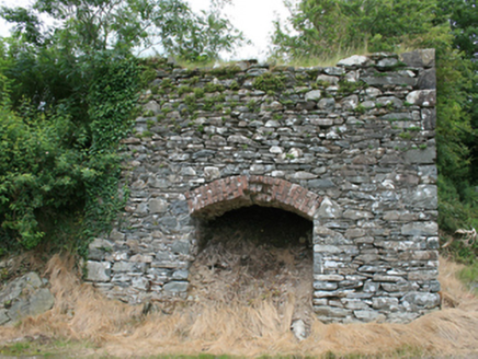 kiln1.7 mi
Explorer Tom Kiln in Fartagh used to bake limestone into lime, which sounds like a very dry cooking method to me. It’s basically an oven for rocks. I’d bet my boots on that.
 Ogham stone (present location) in MullaghOgham stone (present location) · 1.8 mi
Explorer Tom Ogham stone in Mullagh has been moved around so much it's basically a tourist itself. It used to be a headstone, now it's heritage. Whisper a secret at it, it's kept worse.
 Grave YardGraveyard · 1.9 mi
Explorer Tom Graveyard in Mullagh sits near a church called Templekelly, which sounds like a place for naps rather than prayers. There’s a curse here that only affects people who don’t wave hello. Snap one photo, then put the phone away and actually look.
MaperathMountain / peak · 2.0 miCrow IslandIslet · 2.1 miExplorer Tom Crow Island is a dark, mysterious little spot in County Cavan that probably has more crows than you can possibly shake off.
Cloghbally LowerMountain / peak · 2.2 miExplorer Tom Cloghbally Lower sits low and proud in County Cavan, likely hiding from the higher, noisier peaks.
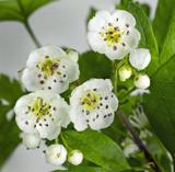 Hawthorn3.3 mi
Explorer Tom Hawthorn in Meath has thorns sharp enough to survive any zombie attack without breaking a sweat. It’s the ultimate defense mechanism, looking prickly but actually quite welcoming if you’re brave enough. Stand still and listen, the wind tells it better than me.
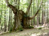 Sweet Chestnut4.4 mi
Explorer Tom Sweet Chestnut in County Meath would make Saint Patrick choke on his asparagus. It's too sweet for its own good, like a toddler with a lollipop. Stand still and listen, the wind tells it better than me.
 Kells Round TowerMemorial · 5.1 mi
 Kells High Crosses and Round TowerMemorial · 5.1 mi
More archaeology and monuments in County Meath · All of County Meath

What do you know about this place?Tap to add a comment or ask a question