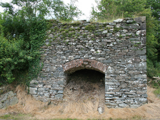
What is recorded here
Freestanding rubble stone limekiln, built c.1870, set against earthen mound. Now disused. Coursed-random rubble sandstone and limestone walls with red brick segmental head to draw arch.
A well-preserved limekiln, demonstrating the use of lime from burnt limestone for agriculture and building which was widespread in the nineteenth century. The structure is part of the industrial heritage of the county and is an interesting architectural component of the historic rural landscape.
From the Buildings of Ireland (National Inventory of Architectural Heritage) record 40404404
This does not grant access. Most recorded buildings are privately owned; view them only from public ground unless the owner allows entry.
Places near here
Photo credits
- National Inventory of Architectural Heritage
- Eric Jones, Geograph · Creative Commons Attribution-ShareAlike 2.0
- Kieran Campbell, Geograph · Creative Commons Attribution-ShareAlike 2.0
- Wanfried-Dublin, Wikimedia Commons · CC BY 4.0
- Didier Descouens, Wikimedia Commons · CC BY-SA 4.0
- Maker named on the Wikimedia Commons picture page · CC BY-SA 2.5
- Bob Embleton, Geograph · CC BY-SA 2.0
- Bill Griffiths, Wikimedia Commons · CC BY-SA 2.0
- Haydn Hammerton, Wikimedia Commons · CC BY-SA 4.0
- Nigel Thompson, Geograph · CC BY-SA 2.0
- Mark Duncan, Geograph · CC BY-SA 2.0
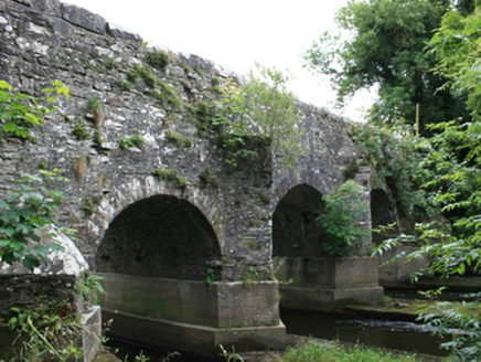 O'Daly's BridgeBridge · 1.3 miFortsCastle, motte and bailey · 1.4 mi
 St Matthew's Roman Catholic ChurchChurch/chapel · 1.7 mi
 Grave YardGraveyard · 2.3 mi
.jpg/250px-Rantavan-Mullagh_(2).jpg "Photo: Wanfried-Dublin, Wikimedia Commons · CC BY 4.0") Ogham stone (present location) in MullaghOgham stone (present location) · 2.5 mi
Ogham stone (present location) in MullaghOgham stone (present location) · 2.5 mi Hawthorn3.6 mi
 Sessile Oak4.2 mi
 Earthen TumulusCastle, motte · 4.5 mi
 Slieve Na CalliaghMountain / peak · 5.5 mi
 Loughcrew Megalithic TombsHeritage attraction · 5.5 mi
 Kells Round TowerMemorial · 6.2 mi
 Kells High Crosses and Round TowerMemorial · 6.2 mi
More historic places in County Cavan · All of County Cavan
What do you know about this place?