What is recorded here
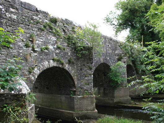
Six-arch rubble stone road bridge, built 1762, spanning north-south over Blackwater River. Concrete bases to piers added c.2000. Random-coursed squared parapet with Scotch coping, pedestrian refuge to east face and ashlar plaque reading ‘O’Daly’s Bridge, Built AD 1762’. Random coursed rubble stone wall with vertical random coping to south-east parapet with circular-profile piers and cast-iron gate to northern side. Random-coursed rubble stone spandrels, parapet, and wing walls. Round-headed arches with cut-stone voussoirs, random-rubble soffit to barrel with traces of lime render and recent grouting. Random rubble V-cutwaters with rendered coping, two-stage stepped cutwaters to central piers, single-stage cutwaters to outer piers of western face.
A substantial example of a mid eighteenth century bridge with original detailing and an inscribed date stone. Spanning the Meath and Cavan border, the bridge provides physical evidence of the significant development of the road network in the county during the eighteenth century. Its construction demonstates the technology used for structural infrastructure in this period. The bridge is well composed and proportioned, and is distinguished by interesting stepped cutwaters.
This does not grant access. Most recorded buildings are privately owned; view them only from public ground unless the owner allows entry.
Places near here
 bridgebridge · 658 yd
 Church in EdenburtChurch · 669 yd
 Mote of DerverArchaeological place · 955 yd
 FortsCastle, motte and bailey · 976 yd
 IndicatedEnclosure · 1.0 mi
 Balgree MoteCastle, motte · 1.3 mi
 Ballyhist WoodWood · 1.5 mi
 Woodpole Fox CovertWood · 1.7 mi
 IslandboyIslet · 2.6 mi
 Stony IslandIslet · 2.8 mi
 Cloghbally LowerMountain / peak · 2.9 mi
 IslandMountain / peak · 3.2 mi
Other information
Photo: National Inventory of Architectural Heritage · Website use allowed for educational or private purposes with source credit