What is recorded here
On W side of trackway, c. 70m N of Temple Athea church and graveyard (LI034-004001-/002-). Well still in holy use and area around it maintained for use of visitors to well. Gate from trackway gives access to rectangular area (6.5m N-S; 4.5m E-W), c. 0.4m lower than level of trackway, defined by low kerb, outside which trees and shrubs shelter site. Well itself in N half of this area, with altar to its E, and a sunken feature with water flowing through a drain at its base. Well is circular in plan (diam. 0.7m) enclosed by stone facing, with opening facing W part of which is also stone faced. However well now encased in concrete setting with steps down to well area and low perimeter walling. On latter sit numerous cups; rags are tied to surrounding trees. Ó Danachair (1955, 215) recorded the following details about Tobermurry; 'A spring well. Enclosed and embellished with statues of Our Lady, St John the Baptist and St Bartholemew. Rounds are still made frequently. Days of special devotion are 25th March, 1st May, 24th June, 15th August and 24th August and the Saturdays before these dates. Formerly a pattern was held on 24th August, the feast of St Bartholemew, the patron of the ecclesiastical parish of Athea, but was discontinued in the 1880's. The water cures many afflictions; rags and small religious objects are left as offerings and there is a collection box for coins. Legends: The well moved when profaned. A trout is seen by the suppliant whose request will be granted. The well sprang up on the spot where a woman died during a famine. The water will not boil. A blind horse was brought to make the rounds; the horse was cured and the owner blinded. A treasure, guarded by a phantom bull, is buried near the well'.
On W side of trackway, c. 70m N of Temple Athea church and graveyard (LI034-004001-/002-). Well still in holy use and area around it maintained for use of visitors to well. Gate from trackway gives access to rectangular area (6.5m N-S; 4.5m E-W), c. 0.4m lower than level of trackway, defined by low kerb, outside which trees and shrubs shelter site. Well itself in N half of this area, with altar to its E, and a…
From the National Monuments Service (Archaeological Survey of Ireland) record LI034-005
The monument record does not grant public access. Check the route and ask the landowner before entering private land.
- What survives
- Recorded monument
Places near here
Photo credits
- jonleebotany, Wikimedia Commons · CC0
- National Inventory of Architectural Heritage
- Garry Dickinson, Wikimedia Commons · CC BY-SA 2.0
- Philip Halling, Geograph · CC BY-SA 2.0
- N Chadwick, Geograph · CC BY-SA 2.0
- No machine-readable author provided. Larsoner~commonswiki assumed (based on copyright claims)., Wikimedia Commons · Public domain
- Unknown author Unknown author, Wikimedia Commons · Public domain
- Borvan53, Wikimedia Commons · CC BY-SA 3.0
- Colin Park, Geograph · CC BY-SA 2.0
- Charles W Glynn, Wikimedia Commons · CC BY-SA 2.0
 Lawson's Cypress3 yd
 New Park HouseCountry house · 897 yd
 handball alley1490 ydOutlinedHoly well · 1.7 mi
 Glin CastleCastle · 6.9 mi
 John B. KeaneMemorial · 8.6 mi
 John B. KeaneMemorial · 9.1 mi
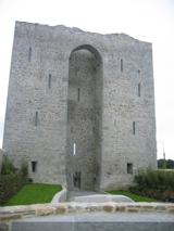 Listowel Castle (in ruins)Castle, tower house · 9.1 mi
 Lartigue MonorailMuseum · 9.2 mi
 Siege of Carrigafoyle CastleSiege · 12 mi
 Carrig IslandIsland · 12 mi
 Ballymacrinan BayBay · 12 mi
More archaeology and monuments in County Limerick · All of County Limerick
What do you know about this place?