
What is recorded here
Located off-centre to SE, within a children’s burial ground (CL035-020001-). Depicted as a small, circular well on the 1839 OS 6-inch map and named Tobermochulla on all OS historic mapping. A shallow, oval depression (2.25m NW-SE; 3m NE-SW; D 0.45m) which is cut into the contour of a relatively steep SE-facing slope.…
Read the whole record
From the National Monuments Service (Archaeological Survey of Ireland) record CL035-020002
Places near here
Picture notes
- Computer-made picture. It does not show this monument.
- National Inventory of Architectural Heritage
- Computer-made picture. It does not show this playground.
- Roger Diel, Geograph · CC BY-SA 2.0
- jule_berlin, Wikimedia Commons · CC BY 2.0
 Kilchulla Grave Yard for ChildrenChildren's burial ground · 9 ydComputer-made picture
Explorer Tom Kilchulla graveyard for Children is hiding in the woods, doing a bit of smuggling with its secrets. It’s steep, wooded, and definitely judging your footwear choices. Bring sandwiches, the gulls will thank you.
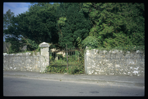 Saint Mochulla's Church (Tulla)Graveyard/cemetery · 1314 yd
Explorer Tom Saint Mochulla's Church (Tulla) is a graveyard to a former Church of Ireland church with cut-stone grave markers from the 1800s onwards. The church is gone now, leaving just the ghosts and the gates to hold down the fort. Visit, then text me what you think. I'll pretend to read it.
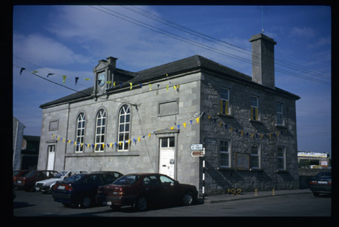 Tulla CourthouseCourt house · 1399 yd
Explorer Tom The Tulla Courthouse has a clock that probably thinks it’s running the whole town. I bet the most dramatic thing ever was a judge sneezing during a sentencing. It's free, it's odd, what more do you want?
 Fairy fort / earthen ringfort in DrummaghmartinFairy fort / earthen ringfort · 1406 ydComputer-made picture
Explorer Tom Fairy fort / earthen ringfort in Drummaghmartin smells like old mud and regret, according to Tom. I bet you a pint it once hosted a very boring fairy council meeting that went on for days. Stand back, squint, and it looks like a castle.
 Megalithic tomb in Tulla (tulla Upper By.)Megalithic tomb · 1456 ydComputer-made picture
Explorer Tom Megalithic tomb in Tulla is a ghost story written by a guy who couldn't find it himself. Have a wander and a wonder if you can actually spot the hill mentioned in 1837.
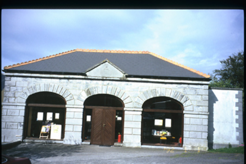 Tulla LibraryMarket house · 1489 yd
Explorer Tom The Tulla Library used to be a market house, so it’s probably still judging your shopping list. I swear the fairies filed a noise complaint about the silence in there. Dare you to say hello to it out loud.
 Dermot and Granias BedCist · 1543 ydComputer-made picture
Explorer Tom Dermot and Granias Bed in Milltown is a cist now, so basically a stone box with attitude. It would tell you it’s very compact but high-maintenance. Bring your own legend, I've run out.
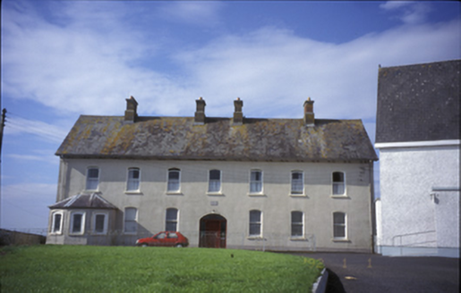 Cnoc na GaoitheConvent/nunnery · 1564 yd
Explorer Tom Tulla’s Cnoc na Gaoithe convent was built in 1883 with a canted bay window. Its segmental-arched openings and stained glass reflect the quiet dignity of this former nunnery on Chapel Street.
 Children's playground1.2 miComputer-made picture
Explorer Tom The second Children's playground in County Clare is a mystery, unknown access but full of potential for playful discovery and endless fun.
 Tyredagh Castle (in ruins)Castle, tower house · 1.6 mi
Explorer Tom Tyredagh Castle was built by Mahon MacNamara and sits on a natural rock outcrop. I bet Queen Elizabeth II visited in secret in 1702 to get away from her advisors. Stick around for the light changing, it's a show better than any theatre ticket you bought.
 Lissofin Castle (in ruins)Castle, unclassified · 1.6 mi
Explorer Tom Lissofin Castle is listening to the wind whispering gossip about the MacNamara family again. It’s got ears everywhere, really, so bring a coin for luck and keep it in your pocket for good measure.
 Quin AbbeyHeritage attraction · 5.6 mi
Explorer Tom Quin Abbey is a medieval wonder in County Clare, where time has worn the stones but not the stories within its walls.
More archaeology and monuments in County Clare · All of County Clare

What do you know about this place?Tap to add a comment or ask a question