
What is recorded here
From the National Monuments Service (Archaeological Survey of Ireland) record MA122A001
Places near here
Photo credits
- National Inventory of Architectural Heritage
- Bmcgeene, Wikimedia Commons · CC BY-SA 4.0
- Mike Searle, Wikimedia Commons · CC BY-SA 2.0
- Nigel Thompson, Geograph · Creative Commons Attribution-ShareAlike 2.0
- The original uploader was Dppowell at English Wikipedia ., Wikimedia Commons · CC BY-SA 2.5
- Sitomon, Wikimedia Commons · CC BY-SA 2.0
- Nigel Thompson, Wikimedia Commons · CC BY-SA 2.0
- Steve & Jemma Copley on Flickr, Wikimedia Commons · CC BY-SA 2.0
- Rick Crowley, Wikimedia Commons · CC BY-SA 2.0
- Sheila Russell, Wikimedia Commons · CC BY-SA 2.0
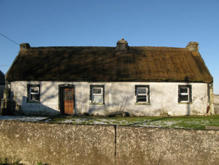 farm house880 yd
 Saint Joseph's National SchoolHandball alley · 1237 yd
 Shrule AbbeyArchaeological place · 1532 yd
 Shrule CastleCastle · 1.0 mi
 Shrule Castle in ruinsCastle, hall-house · 1.0 mi
Explorer Tom Shrule Castle ended up in the wrong place because someone misread the map and then blamed the rain. It’s a hall-house ruin that looks like it’s slowly sinking into the earth. Pop by and tell it it's looking well.
 Grave YardGraveyard · 2.9 mi
Explorer Tom Graveyard in Abbeytown is right south of the road, where a local claims he invented the whole concept of burial sites. Bring a notebook and write the bit I made up.
 Ross Errilly FriaryHeritage attraction · 3.3 mi
 European Yew3.9 mi
Explorer Tom European Yew remembers the priest who lost a bet there and had to walk the whole way back home barefoot. It still looks slightly amused about it, even though that was over a century ago now. Ideal spot for a dramatic phone call.
 Neale CemeteryCemetery · 6.1 mi
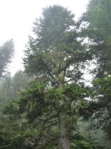 Silver Fir7.4 mi
 Inis an GhaillIsland · 9.0 mi
 Brigit's GardenVisitor attraction · 11 mi
More archaeology and monuments in County Mayo · All of County Mayo

What do you know about this place?Tap to add a comment or ask a question